Latitude: 50.3823 / 50°22'56"N
Longitude: -3.5958 / 3°35'44"W
OS Eastings: 286640
OS Northings: 54815
OS Grid: SX866548
Mapcode National: GBR QR.HKT7
Mapcode Global: FRA 38C1.0ZM
Plus Code: 9C2R9CJ3+WM
Entry Name: The Ferry Boat Inn
Listing Date: 26 April 1993
Grade: II
Source: Historic England
Source ID: 1289299
English Heritage Legacy ID: 101206
ID on this website: 101289299
DITTISHAM SX8654-SX8754 MANOR STREET 17/294 DITTISHAM (North side), The Ferry Boat Inn
GV II
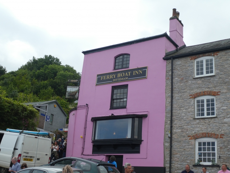
Public House. Probably C18, remodelled in circa mid C19 and with C20 alterations. Stone rubble with rendered south and wet elevations. Slate roof with gabled left hand north end and hipped right hand south end; black glazed ridge tiles. Projecting stone rubble stack at left hand end with rebuilt rendered shaft and turned clay pot. Plan: Rectangular Plan. Probably originally 2 rooms with a central entrance, the left hand room heated from a gable end stack, the right hand room has a rear lateral stack and a cellar below with access to the lower level from the shore of the River Dart at this end. The building was much altered internally probably in the C20 and the ground floor partitions were removed and a bowed single storey extension was added across the front. Exterior: 2 storeys. Symmetrical 2-windows south front. On first and second floor C20 2-light casements with glazing bars, the second floor in cambered head openings. Across the ground storey of front a single storey bowed edtension was built in the C20 with a flat roof, a round-headed central doorway with a plank door, a mantle-pane fixed light window to the left and a C20 sash to the right. The right hand east end facing the river has C20 windows, a 2-light second floor casement with a cambered head, a 16 pane first floor sash and a wide ariel on the ground floor with a cellar doorway below with a C20 door. Interior: Not inspected.
Listing NGR: SX8664054815
External links are from the relevant listing authority and, where applicable, Wikidata. Wikidata IDs may be related buildings as well as this specific building. If you want to add or update a link, you will need to do so by editing the Wikidata entry.


Other nearby listed buildings