Approximate Location Map
Large Map »
Latitude: 51.7836 / 51°47'1"N
Longitude: -1.4865 / 1°29'11"W
OS Eastings: 435517
OS Northings: 209565
OS Grid: SP355095
Mapcode National: GBR 6VS.30R
Mapcode Global: VHC02.5FZJ
Plus Code: 9C3WQGM7+F9
Entry Name: 9, Corn Street
Listing Date: 6 February 1970
Grade: II
Source: Historic England
Source ID: 1289450
English Heritage Legacy ID: 397144
ID on this website: 101289450
Location: Witney, West Oxfordshire, OX28
County: Oxfordshire
District: West Oxfordshire
Civil Parish: Witney
Built-Up Area: Witney
Traditional County: Oxfordshire
Lieutenancy Area (Ceremonial County): Oxfordshire
Church of England Parish: Witney
Church of England Diocese: Oxford
Tagged with: Building
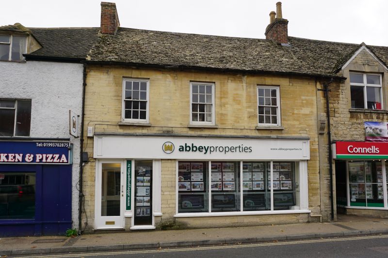
WITNEY CORN STREET
SP3509N (South side)
10/123 No.9
06/02/70
GV II
(Shown on OS map as No.9 and No.11.)
House, now office. Late C18. Limestone ashlar, of small blocks; gabled stone
slate roof; brick end stacks. 2 storeys; 3-window range, Keyed stone lintels
over 6-pane sashes and central blind window above C20 shop front. Interior not
inspected.
Listing NGR: SP3551709565
External links are from the relevant listing authority and, where applicable, Wikidata. Wikidata IDs may be related buildings as well as this specific building. If you want to add or update a link, you will need to do so by editing the Wikidata entry.


Other nearby listed buildings
