Latitude: 51.4933 / 51°29'35"N
Longitude: -0.1499 / 0°8'59"W
OS Eastings: 528531
OS Northings: 178769
OS Grid: TQ285787
Mapcode National: GBR BL.HW
Mapcode Global: VHGQZ.CQ2M
Plus Code: 9C3XFVV2+82
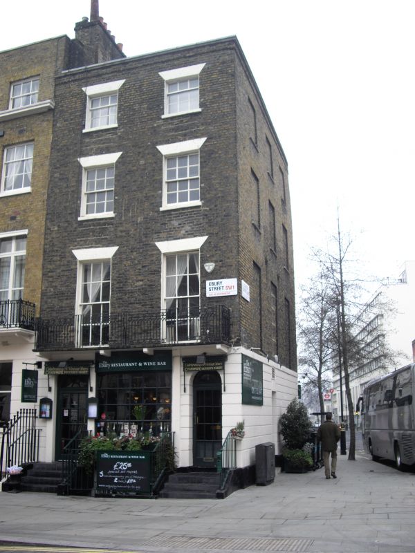
Entry Name: 139, Ebury Street SW1
Listing Date: 1 December 1987
Grade: II
Source: Historic England
Source ID: 1290094
English Heritage Legacy ID: 209616
ID on this website: 101290094
Location: Belgravia, Westminster, London, SW1W
County: London
District: City of Westminster
Electoral Ward/Division: Churchill
Parish: Non Civil Parish
Built-Up Area: City of Westminster
Traditional County: Middlesex
Lieutenancy Area (Ceremonial County): Greater London
Church of England Parish: St Michael Chester Square
Church of England Diocese: London
Tagged with: Building
TQ 2878 NE CITY OF WESTMINSTER EBURY STREET, SW1
103/15 (south-east side)
No 139
GV II
House. Shop to ground floor. Early C19 altered. 4 storeys, 2 windows
wide. Brick, chanelled stucco to ground floor. Roof not visible. House doorway
to right, panelled door. Pilastered shop doorway, C19, to left and bar window
between. Iron balcony to first floor of "Gothick" design. Square headed
windows, sashes, gauged heads, glazing bars. Parapet. Return to right with
blind windows. Included for group value only.
Listing NGR: TQ2853178769
External links are from the relevant listing authority and, where applicable, Wikidata. Wikidata IDs may be related buildings as well as this specific building. If you want to add or update a link, you will need to do so by editing the Wikidata entry.


Other nearby listed buildings