Latitude: 54.7244 / 54°43'27"N
Longitude: -2.794 / 2°47'38"W
OS Eastings: 348958
OS Northings: 536893
OS Grid: NY489368
Mapcode National: GBR 8FXT.X6
Mapcode Global: WH80Y.1JT1
Plus Code: 9C6VP6F4+QC
Entry Name: Middle Bridge
Listing Date: 24 October 1986
Grade: II
Source: Historic England
Source ID: 1290417
English Heritage Legacy ID: 73878
ID on this website: 101290417
Location: Brockleymoor, Westmorland and Furness, Cumbria, CA11
County: Cumbria
District: Eden
Civil Parish: Hesket
Traditional County: Cumberland
Lieutenancy Area (Ceremonial County): Cumbria
Church of England Parish: Plumpton Wall St John the Evangelist
Church of England Diocese: Carlisle
Tagged with: Bridge
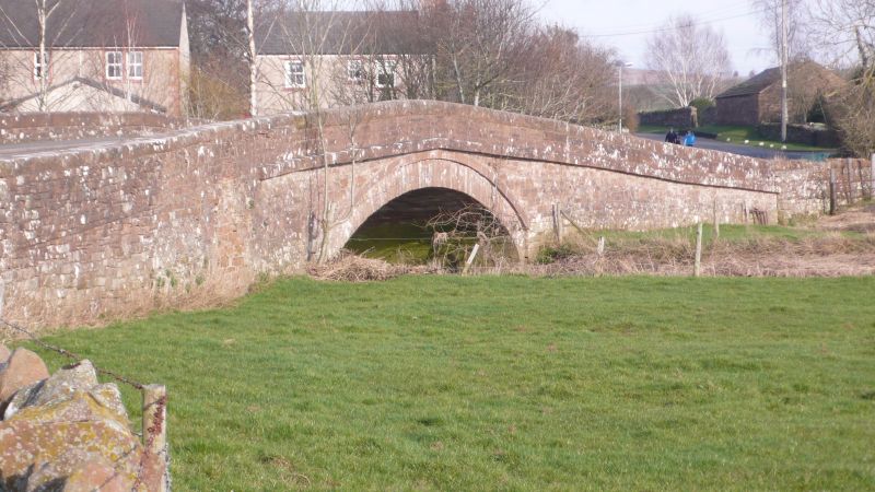
NY 43 NE HESKET BROCKLEYMOOR
10/153 Middle Bridge
II
Roadbridge. Dated 1855 on parapet. Red sandstone. Single segmental arch and
small overflow channel. Rusticated voussoirs under string course and solid
parapets. Overflow channel has 2 vaulted passages.
Listing NGR: NY4895836893
External links are from the relevant listing authority and, where applicable, Wikidata. Wikidata IDs may be related buildings as well as this specific building. If you want to add or update a link, you will need to do so by editing the Wikidata entry.


Other nearby listed buildings