Latitude: 54.0492 / 54°2'57"N
Longitude: -2.8055 / 2°48'19"W
OS Eastings: 347358
OS Northings: 461767
OS Grid: SD473617
Mapcode National: GBR 8PVM.D7
Mapcode Global: WH846.WH76
Plus Code: 9C6V25XV+MR
Entry Name: 16, Castle Park
Listing Date: 22 December 1953
Grade: II
Source: Historic England
Source ID: 1290789
English Heritage Legacy ID: 383082
ID on this website: 101290789
Location: Lancaster, Lancashire, LA1
County: Lancashire
District: Lancaster
Electoral Ward/Division: Castle
Parish: Non Civil Parish
Built-Up Area: Lancaster
Traditional County: Lancashire
Lieutenancy Area (Ceremonial County): Lancashire
Church of England Parish: Lancaster St Mary with St John and St Anne
Church of England Diocese: Blackburn
Tagged with: Building
LANCASTER
SD4761NW CASTLE PARK 1685-1/6/50 (South side) 22/12/53 No.16
GV II
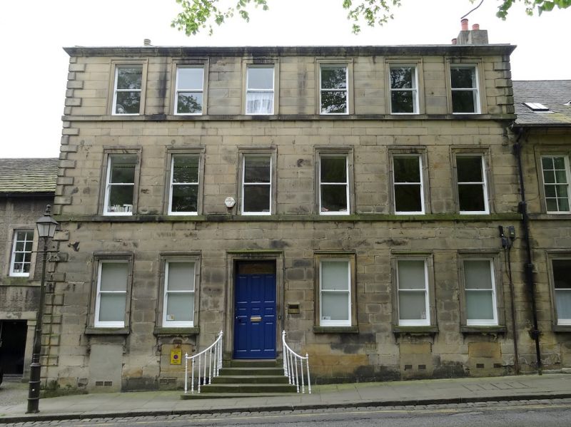
House, formerly 2 houses, originally part of a row of 5, now offices. Mid C18, raised and altered C19. Sandstone ashlar with ashlar dressings on the front and side, coursed rubble on the rear with a rendered second storey. Slate roof hipped to the left with a chimney set back towards the rear, and a gable chimney stack to the right. T-plan with a double-depth front range, with a 2-storey bow window on the back wall to the left, and a rear wing extended into a former outbuilding. 3 storeys above a cellar and 6 bays under an eaves cornice, with the doorway in the third bay and with chamfered quoins to the left, and to the right on the second floor above the junction with No.14 (qv). The sill bands on first and second floors return around the left-hand gable wall, where there is a window on each floor. All the windows have moulded architraves, as does the doorway, and are sashed without glazing bars. The doorway is approached up a flight of 4 steps with railings of cast-iron 'turned' balusters and standards with urn finials. The recessed door has 9 panels and an integral overlight. Rebuilt stonework to the right of the door, and the Ordnance Survey 5 feet to one mile map surveyed in 1845, suggest that there were originally paired entrance doorways in the 2 central bays.
Listing NGR: SD4735661760
External links are from the relevant listing authority and, where applicable, Wikidata. Wikidata IDs may be related buildings as well as this specific building. If you want to add or update a link, you will need to do so by editing the Wikidata entry.


Other nearby listed buildings