Approximate Location Map
Large Map »
Latitude: 51.4804 / 51°28'49"N
Longitude: -2.7701 / 2°46'12"W
OS Eastings: 346618
OS Northings: 175999
OS Grid: ST466759
Mapcode National: GBR JH.KV8T
Mapcode Global: VH7C2.X1XY
Plus Code: 9C3VF6JH+5X
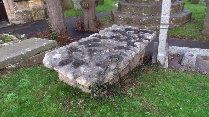
Entry Name: Tomb of John Hobbes to West of Medieval Churchyard Cross
Listing Date: 4 August 1981
Grade: II
Source: Historic England
Source ID: 1291082
English Heritage Legacy ID: 394002
ID on this website: 101291082
Location: St Peter's Church, Portishead, North Somerset, BS20
County: North Somerset
Civil Parish: Portishead
Built-Up Area: Portishead
Traditional County: Somerset
Lieutenancy Area (Ceremonial County): Somerset
Tagged with: Tomb
1.
5121 CHURCH ROAD SOUTH
(north side)
Tomb of John Hobbes
to west of Medieval
Churchyard Cross
ST 4676 3/5A
II GV
2.
Early C17 (Hobbes died 1616). Low table tomb. To west of churchyard cross
(qv), close to south porch.
Listing NGR: ST4662775999
External links are from the relevant listing authority and, where applicable, Wikidata. Wikidata IDs may be related buildings as well as this specific building. If you want to add or update a link, you will need to do so by editing the Wikidata entry.


Other nearby listed buildings
