Approximate Location Map
Large Map »
Latitude: 51.48 / 51°28'48"N
Longitude: -2.7691 / 2°46'8"W
OS Eastings: 346686
OS Northings: 175956
OS Grid: ST466759
Mapcode National: GBR JH.KVL0
Mapcode Global: VH7C2.Y2G7
Plus Code: 9C3VF6JJ+29
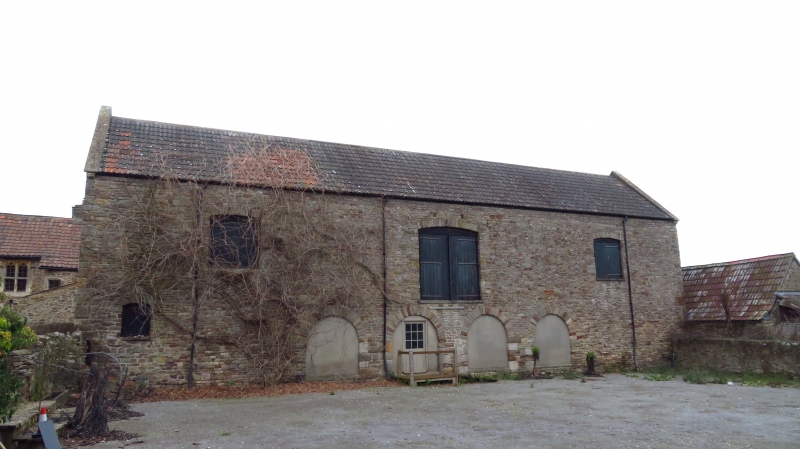
Entry Name: Barn to East of Court House Farmhouse
Listing Date: 4 August 1981
Grade: II
Source: Historic England
Source ID: 1220238
English Heritage Legacy ID: 394005
ID on this website: 101220238
Location: Portishead, North Somerset, BS20
County: North Somerset
Civil Parish: Portishead
Built-Up Area: Portishead
Traditional County: Somerset
Lieutenancy Area (Ceremonial County): Somerset
Tagged with: Barn
1.
5121 CHURCH ROAD SOUTH
(north side)
Barn to east of
Court House Farmhouse
ST 4675 4/8
II GV
2.
C19 rubble with freestone dressings. Double Roman tiled roof, 4 round headed
entrances in centre of south front with loading door above.
Listing NGR: ST4668675956
External links are from the relevant listing authority and, where applicable, Wikidata. Wikidata IDs may be related buildings as well as this specific building. If you want to add or update a link, you will need to do so by editing the Wikidata entry.


Other nearby listed buildings
