Latitude: 52.754 / 52°45'14"N
Longitude: 0.3934 / 0°23'36"E
OS Eastings: 561623
OS Northings: 320059
OS Grid: TF616200
Mapcode National: GBR N3Q.B9K
Mapcode Global: WHJP7.01MK
Plus Code: 9F42Q93V+H9
Entry Name: 1, King Street
Listing Date: 7 June 1972
Grade: II
Source: Historic England
Source ID: 1291147
English Heritage Legacy ID: 384136
ID on this website: 101291147
Location: King's Lynn, King's Lynn and West Norfolk, Norfolk, PE30
County: Norfolk
District: King's Lynn and West Norfolk
Electoral Ward/Division: St Margarets with St Nicholas
Parish: Non Civil Parish
Built-Up Area: King's Lynn
Traditional County: Norfolk
Lieutenancy Area (Ceremonial County): Norfolk
Tagged with: Building
KING'S LYNN
TF6120SE KING STREET 610-1/7/65 (West side) 07/06/72 No.1
GV II
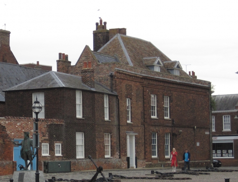
House, partly used as offices. Built c1670 for Sir John Turner, facade of c1750, Purfleet Quay return early C18, interior probably older. Red brick with plaintile roof. 2 storeys in 3 bays. Panelled door with panelled reveals to right, behind open-pedimented doorcase on Ionic engaged columns, beside which there is a wrought-iron lantern bracket. 2 sashes to left with glazing bars and gauged skewback arches in light red brick. 3 similar to first floor. Dentil timber cornice below plain parapet. Hipped roof. Purfleet Quay front (south). 2 storeys. Plinth course with ashlar coping. West extent of original build defined by rusticated quoins, immediately to the right of which are 2 sash windows each floor with glazing bars and gauged skewback arches. Platband between floors and a double brick string course below the parapet. Parapet continues into single-bay extension to west and into north return. Extension has one sash each floor to south with glazing bars and gauged skewback arches. A further 2-storey, but lower, late C18 extension abuts to west: one sash each floor with glazing bars and gauged skewback arches. Hipped slate roof. (Engravings: Bell: 1685-).
Listing NGR: TF6162320059
External links are from the relevant listing authority and, where applicable, Wikidata. Wikidata IDs may be related buildings as well as this specific building. If you want to add or update a link, you will need to do so by editing the Wikidata entry.


Other nearby listed buildings