Latitude: 54.1329 / 54°7'58"N
Longitude: -0.791 / 0°47'27"W
OS Eastings: 479097
OS Northings: 471462
OS Grid: SE790714
Mapcode National: GBR QNXN.K6
Mapcode Global: WHFBG.TCJZ
Plus Code: 9C6X46M5+5J
Entry Name: Malton Bridge
Listing Date: 10 June 1974
Grade: II
Source: Historic England
Source ID: 1291522
English Heritage Legacy ID: 389383
ID on this website: 101291522
Location: Malton, North Yorkshire, YO17
County: North Yorkshire
District: Ryedale
Civil Parish: Malton
Built-Up Area: Malton
Traditional County: Yorkshire
Lieutenancy Area (Ceremonial County): North Yorkshire
Church of England Parish: New Malton St Michael
Church of England Diocese: York
SE7971
801-1/7/4
10/06/74
MALTON
B1248
Malton Bridge
GV
II
Formerly known as: MOLTON BRIDGE.
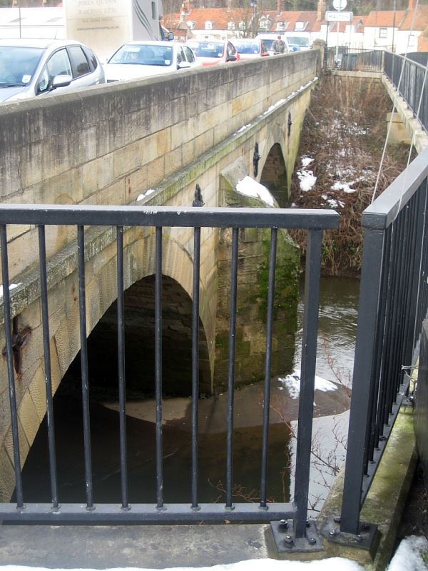
Bridge. c1760; widened and parapet partly rebuilt in C20.
Original bridge probably by John Carr. Sandstone ashlar:
widened by the addition of a concrete walkway with iron
railings. 3 spans crossing the River Derwent and a mid-stream
island. Semicircular arches of voussoirs, with roll mouldings
on the downstream side, and cutwaters between arches at the
Norton end. Raised chamfered band on the upstream side,
beneath plain cambered parapet. Original downstream parapet
survives alongside the later walkway. South end in
Norton-on-Derwent CP. Bridge under repair at time of list
review (1990).
Listing NGR: SE7909771462


Other nearby listed buildings