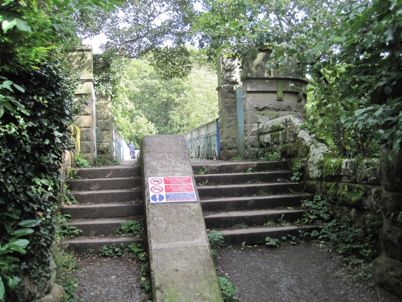
Latitude: 54.5459 / 54°32'45"N
Longitude: -1.9305 / 1°55'49"W
OS Eastings: 404590
OS Northings: 516736
OS Grid: NZ045167
Mapcode National: GBR GHYW.V6
Mapcode Global: WHB4D.9ZYY
Plus Code: 9C6WG3W9+8Q
Entry Name: Deepdale Aqueduct (That Part in Barnard Castle Civil Parish)
Listing Date: 28 November 1994
Grade: II
Source: Historic England
Source ID: 1291706
English Heritage Legacy ID: 388855
Also known as: Deepdale Footbridge
Deepdale bridge
ID on this website: 101291706
Location: Startforth, County Durham, DL12
County: County Durham
Civil Parish: Barnard Castle
Traditional County: Durham
Lieutenancy Area (Ceremonial County): County Durham
Church of England Parish: Barnard Castle with Whorlton
Church of England Diocese: Durham
Tagged with: Aqueduct Footbridge
BARNARD CASTLE
NZ0416NE VERE ROAD 770-1/3/226 (West side (off)) Deepdale Aqueduct (that part in Barnard Castle CP)
II
Aqueduct with footbridge over River Tees. Dated 1898 on founder's plaque. Engineers: Head Wrighton & Co. Ltd, Thornaby on Tees. For the Stockton and Middlesbrough Water Board. Cast-iron aqueduct and footbridge parapets with rock-faced stone steps and piers. Castle style. 2 pairs of round cast-iron piers have plinths on stone bases, label moulding below plain capitals, and carry beams of deck. Octagonal piers at east end have corbel table and coped parapet. Parapet walls step up from piers and abut tall octagonal turrets with battlemented parapets entered by stone steps from footbridge. Wrought-iron lattice parapets from these flank water pipe and carry timber deck of foot bridge, raised over water pipe. See also Startforth CP.
Listing NGR: NZ0459016736
External links are from the relevant listing authority and, where applicable, Wikidata. Wikidata IDs may be related buildings as well as this specific building. If you want to add or update a link, you will need to do so by editing the Wikidata entry.


Other nearby listed buildings