Approximate Location Map
Large Map »
Latitude: 49.9119 / 49°54'42"N
Longitude: -6.3003 / 6°18'1"W
OS Eastings: 91384
OS Northings: 10162
OS Grid: SV913101
Mapcode National: GBR BXTX.JZ0
Mapcode Global: VGYC4.RG4Y
Plus Code: 8CXMWM6X+PV
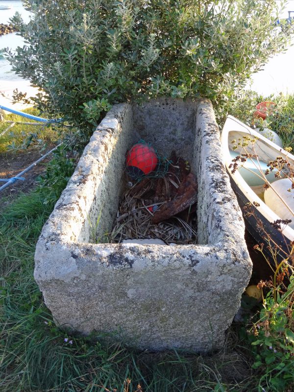
Entry Name: Former Fish Salting Trough on East Side of Old Town Bay
Listing Date: 14 December 1992
Grade: II
Source: Historic England
Source ID: 1291939
English Heritage Legacy ID: 62475
ID on this website: 101291939
Location: Old Town, Isles of Scilly, Cornwall, TR21
County: Isles of Scilly
Civil Parish: St. Mary's
Lieutenancy Area (Ceremonial County): Cornwall
Church of England Parish: Isles of Scilly
Church of England Diocese: Truro
Tagged with: Manger
ST. MARY'S
SV9010 OLD TOWN
1358-0/8/107 Former Fish Salting Trough on E side
of Old Town Bay
II
Former fish salting trough. Probably C18. Granite trough.
Recorded by James Troutbeck, antiquarian and Chaplain of the
Isles of Scilly between 1780 and 1796.
(Troutbeck, J: History of the Isles of Scilly: Sherborne:
1796-).
Listing NGR: SV9137610189
External links are from the relevant listing authority and, where applicable, Wikidata. Wikidata IDs may be related buildings as well as this specific building. If you want to add or update a link, you will need to do so by editing the Wikidata entry.


Other nearby listed buildings
