Latitude: 53.2607 / 53°15'38"N
Longitude: -2.1269 / 2°7'36"W
OS Eastings: 391630
OS Northings: 373749
OS Grid: SJ916737
Mapcode National: GBR FZLQ.BV
Mapcode Global: WHBBP.99FM
Plus Code: 9C5V7V6F+76
Entry Name: 28, Chestergate
Listing Date: 13 January 1969
Grade: II
Source: Historic England
Source ID: 1291941
English Heritage Legacy ID: 390946
ID on this website: 101291941
Location: Macclesfield, Cheshire East, Cheshire, SK11
County: Cheshire East
Civil Parish: Macclesfield
Built-Up Area: Macclesfield
Traditional County: Cheshire
Lieutenancy Area (Ceremonial County): Cheshire
Church of England Parish: St Michael and All Angels, Macclesfield
Church of England Diocese: Chester
MACCLESFIELD
SJ9173NE CHESTERGATE 886-1/10/46 (South side) 13/01/69 No.28
GV II
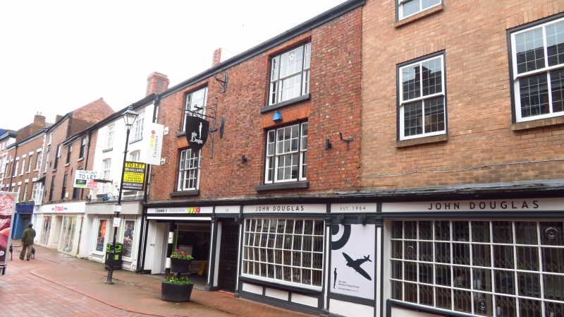
House, now shop. Late C16/early C17 with early C19 frontage. Timber-framed, fronted in brick with slate roof. 3 storeys, 2-window range. Early C19 shallow bow window to right with small panes and moulded cornice. Left-hand side of building now cut through to form passage, the entrance now in the side elevation. Upper windows are sashes with flat-arched brick heads and stone sills. Inside, the original plan appears to have been a 2-unit plan with rear wing, and staircase to one side, running between front and back rooms. Original staircase survives intact, with splat balusters and carved newel posts; chamfered ceiling beams and square panelled wall framing remains visible.
Listing NGR: SJ9163373745
External links are from the relevant listing authority and, where applicable, Wikidata. Wikidata IDs may be related buildings as well as this specific building. If you want to add or update a link, you will need to do so by editing the Wikidata entry.


Other nearby listed buildings