Latitude: 54.5416 / 54°32'29"N
Longitude: -1.9203 / 1°55'13"W
OS Eastings: 405254
OS Northings: 516265
OS Grid: NZ052162
Mapcode National: GBR HH1X.1Q
Mapcode Global: WHB4L.G3SN
Plus Code: 9C6WG3RH+MV
Entry Name: Number 46 and Attached Rear Walls and Outbuilding
Listing Date: 28 November 1994
Grade: II
Source: Historic England
Source ID: 1292125
English Heritage Legacy ID: 388773
ID on this website: 101292125
Location: Barnard Castle, County Durham, DL12
County: County Durham
Civil Parish: Barnard Castle
Built-Up Area: Barnard Castle
Traditional County: Durham
Lieutenancy Area (Ceremonial County): County Durham
Church of England Parish: Barnard Castle with Whorlton
Church of England Diocese: Durham
Tagged with: Building
BARNARD CASTLE
NZ0516SW NEWGATE 770-1/6/143 (North side) No.46 and attached rear walls and outbuilding
GV II
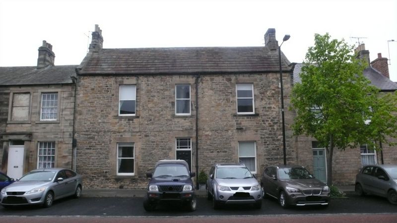
House, later office and flats, then houses and flat, with rear outbuildings and walls. Front rebuilt c1860; rear range probably late C18 (date stone 1799). Irregular courses of squared stone with ashlar plinth, pecked quoins and dressings. Roof of stone slates with stone gable copings and stone and brick chimneys. L-plan with outbuilding against rear wall of small rear yard. 2 storeys; 3-window range. Central 6-panel door and margined overlight with flat stone lintel and alternate block jambs. Plain sash windows with similar lintels and jambs have projecting stone sills. Roof has gable copings on cyma-moulded kneelers; end yellow brick chimneys on stone plinths. Rear shows 2-storey outshut under catslide roof. 2-storey link at rear under monopitch roof, taller side set against lower 2-storey, 4-window rear wing. Ledged boarded door at left with tall 2-pane overlight. Blocked door to right of this has flat stone lintel and inserted window. To right, half-glazed door in plain stone surround. Next, a blocked door with flat stone lintel and inserted window; next right, high wall of house yard breaks forward. Next right, plain stone surround to blocked door, then flat stone lintel and projecting stone sill to sash window with glazing bars. At right a blocked door with lintel inscribed 1799 and initials ?HND partly obscured by rainwater pipe. On first floor, a small opening above the left end door, and C20 2-light casements over other doors. Against yard wall and facing house is an outbuilding, probably originally earth closet and coal store, of rubble with roof of stone slates. One storey and one window: pierced ventilation holes in boarded door, small 4-pane window, and boarded door in right return; pent roof. High wall with flat stone coping forms yard and has flat stone lintel over boarded door adjacent to rear wing. INTERIOR: front range shows C19 tiled central entrance hall with half-glazed screen to inner door; 6-panel doors; panelled reveals to windows; marble chimney piece. Keyed round arch to rear stair.
Listing NGR: NZ0525416265
External links are from the relevant listing authority and, where applicable, Wikidata. Wikidata IDs may be related buildings as well as this specific building. If you want to add or update a link, you will need to do so by editing the Wikidata entry.


Other nearby listed buildings