Latitude: 52.6897 / 52°41'22"N
Longitude: -1.8216 / 1°49'17"W
OS Eastings: 412155
OS Northings: 310233
OS Grid: SK121102
Mapcode National: GBR 4DN.89Q
Mapcode Global: WHCGN.ZNRD
Plus Code: 9C4WM5QH+V9
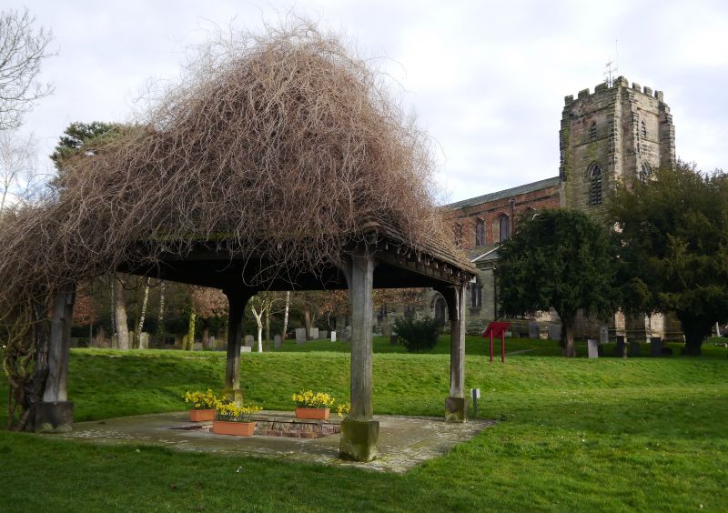
Entry Name: St Chad's Well Approximately 34 Metres to North West of Church of St Chad
Listing Date: 5 February 1952
Last Amended: 17 June 1994
Grade: II
Source: Historic England
Source ID: 1292144
English Heritage Legacy ID: 382710
ID on this website: 101292144
Location: St Chad's Church, Stowe, Lichfield, Staffordshire, WS13
County: Staffordshire
District: Lichfield
Civil Parish: Lichfield
Built-Up Area: Lichfield
Traditional County: Staffordshire
Lieutenancy Area (Ceremonial County): Staffordshire
Church of England Parish: Lichfield St Chad
Church of England Diocese: Lichfield
Tagged with: Architectural structure
LICHFIELD
SK11SW ST CHAD'S ROAD, Stowe 1094-1/1/254 (North side) 05/02/52 St Chad's Well approximately 34m to north-west of Church of St Chad (Formerly Listed as: STOWE HILL St. Chad's Well)
GV II
Holy well. Probably C7 with late C20 canopy. Ashlar and timber; tile roof. Square well with step in surrounding paving. Timber posts support pyramidal tile roof, covered by a vine. Plaque giving history nearby. St Chad established himself here with 8 companions in 669 when he became Bishop of Mercia, and died in 672. The well became a centre of devotion to the saint, who is still commemorated here.
Listing NGR: SK1215510233
External links are from the relevant listing authority and, where applicable, Wikidata. Wikidata IDs may be related buildings as well as this specific building. If you want to add or update a link, you will need to do so by editing the Wikidata entry.


Other nearby listed buildings