Approximate Location Map
Large Map »
Latitude: 51.2955 / 51°17'43"N
Longitude: 0.4088 / 0°24'31"E
OS Eastings: 568041
OS Northings: 157906
OS Grid: TQ680579
Mapcode National: GBR NPC.N67
Mapcode Global: VHJM5.1PHR
Plus Code: 9F327CW5+5G
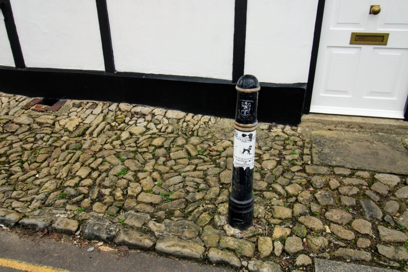
Entry Name: Bollard Opposite No 16 (Prior's Cottage)
Listing Date: 30 November 1993
Grade: II
Source: Historic England
Source ID: 1292822
English Heritage Legacy ID: 392414
ID on this website: 101292822
Location: West Malling, Tonbridge and Malling, Kent, ME19
County: Kent
District: Tonbridge and Malling
Civil Parish: West Malling
Built-Up Area: West Malling
Traditional County: Kent
Lieutenancy Area (Ceremonial County): Kent
Church of England Parish: West Malling St Mary
Church of England Diocese: Rochester
Tagged with: Bollard
WEST MALLING
TQ6857 KING STREET
1156-0/3/103 Bollard opposite No 16 (Prior's
Cottage)
GV II
Bollard. Early to mid C19. Cast-iron, octagonal in shape with
recessed panels and cornice with leaf design on gadrooned
base. Erected to prevent heavy traffic damaging the jetty of
the building.
Listing NGR: TQ6805357907
External links are from the relevant listing authority and, where applicable, Wikidata. Wikidata IDs may be related buildings as well as this specific building. If you want to add or update a link, you will need to do so by editing the Wikidata entry.


Other nearby listed buildings
