Latitude: 51.2954 / 51°17'43"N
Longitude: 0.4088 / 0°24'31"E
OS Eastings: 568038
OS Northings: 157900
OS Grid: TQ680579
Mapcode National: GBR NPC.N68
Mapcode Global: VHJM5.1PGS
Plus Code: 9F327CW5+5G
Entry Name: Bollard Opposite No 18 (The Priors)
Listing Date: 30 November 1993
Grade: II
Source: Historic England
Source ID: 1292823
English Heritage Legacy ID: 392416
ID on this website: 101292823
Location: West Malling, Tonbridge and Malling, Kent, ME19
County: Kent
District: Tonbridge and Malling
Civil Parish: West Malling
Built-Up Area: West Malling
Traditional County: Kent
Lieutenancy Area (Ceremonial County): Kent
Church of England Parish: West Malling St Mary
Church of England Diocese: Rochester
Tagged with: Bollard
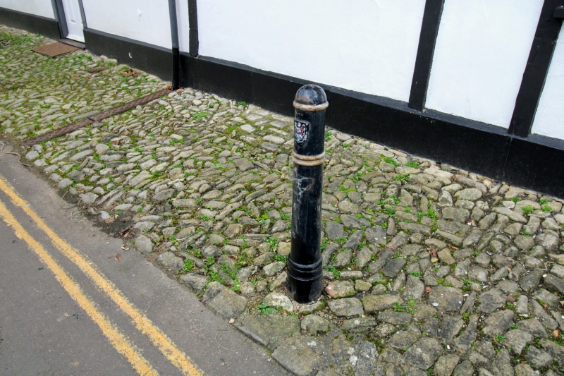
WEST MALLING
TQ6857 KING STREET
1156-0/3/104 Bollard opposite No 18 (The Priors)
GV II
Bollard. Early C19. Cast-iron fluted with knop. 2 embossed
roses and hole on square base, the whole about lm high.
Erected to prevent heavy traffic damaging the jetty of the
building.
Listing NGR: TQ6802757893
External links are from the relevant listing authority and, where applicable, Wikidata. Wikidata IDs may be related buildings as well as this specific building. If you want to add or update a link, you will need to do so by editing the Wikidata entry.


Other nearby listed buildings