Latitude: 53.4115 / 53°24'41"N
Longitude: -2.9399 / 2°56'23"W
OS Eastings: 337620
OS Northings: 390937
OS Grid: SJ376909
Mapcode National: GBR 7GM.11
Mapcode Global: WH877.TH7Z
Plus Code: 9C5VC366+J2
Entry Name: 11 and 13, Lockerby Road
Listing Date: 14 March 1975
Grade: II
Source: Historic England
Source ID: 1293309
English Heritage Legacy ID: 359027
ID on this website: 101293309
Location: Elm Park, Liverpool, Merseyside, L7
County: Liverpool
Electoral Ward/Division: Kensington and Fairfield
Parish: Non Civil Parish
Built-Up Area: Liverpool
Traditional County: Lancashire
Lieutenancy Area (Ceremonial County): Merseyside
Church of England Parish: Liverpool, All Saints
Church of England Diocese: Liverpool
Tagged with: Building
SJ 3790 LOCKERBY ROAD L7
28/692 Nos. ll & 13
14.3.75. - II
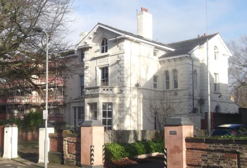
Pair of houses. 1840's. Stucco with slate roof, 2 storeys with attic, 3 bays to each house, outer bays are recessed and of 2 storeys, middle bays project under open pediments. Ground floor lintel band and 1st floor sill course; 2nd floor sill band and deep bracketed eaves; rusticated quoins. Inner bays have projecting windows with entablatures and pierced parapets; tripartite windows have consoled mullions. Middle bays have canted bay windows with pierced parapets. Outer bays have round-headed entrances with large keystones. 1st floor windows have eaved architraves, outer bays have paired round-headed windows. Attic has round-headed windows those to inner bay break through the eaves with bracketed hoods. No. ll has ground floor windows blocked and C20 timber porch. No. 13 has inserted window in 1st floor.
Listing NGR: SJ3762090937
External links are from the relevant listing authority and, where applicable, Wikidata. Wikidata IDs may be related buildings as well as this specific building. If you want to add or update a link, you will need to do so by editing the Wikidata entry.


Other nearby listed buildings