Approximate Location Map
Large Map »
Latitude: 53.413 / 53°24'46"N
Longitude: -2.9381 / 2°56'17"W
OS Eastings: 337743
OS Northings: 391095
OS Grid: SJ377910
Mapcode National: GBR 7GL.FJ
Mapcode Global: WH877.VG3W
Plus Code: 9C5VC376+5Q
Entry Name: 4, Laurel Road
Listing Date: 19 June 1985
Grade: II
Source: Historic England
Source ID: 1084205
English Heritage Legacy ID: 359012
ID on this website: 101084205
Location: Elm Park, Liverpool, Merseyside, L7
County: Liverpool
Electoral Ward/Division: Kensington and Fairfield
Parish: Non Civil Parish
Built-Up Area: Liverpool
Traditional County: Lancashire
Lieutenancy Area (Ceremonial County): Merseyside
Church of England Parish: Liverpool, All Saints
Church of England Diocese: Liverpool
Tagged with: Building
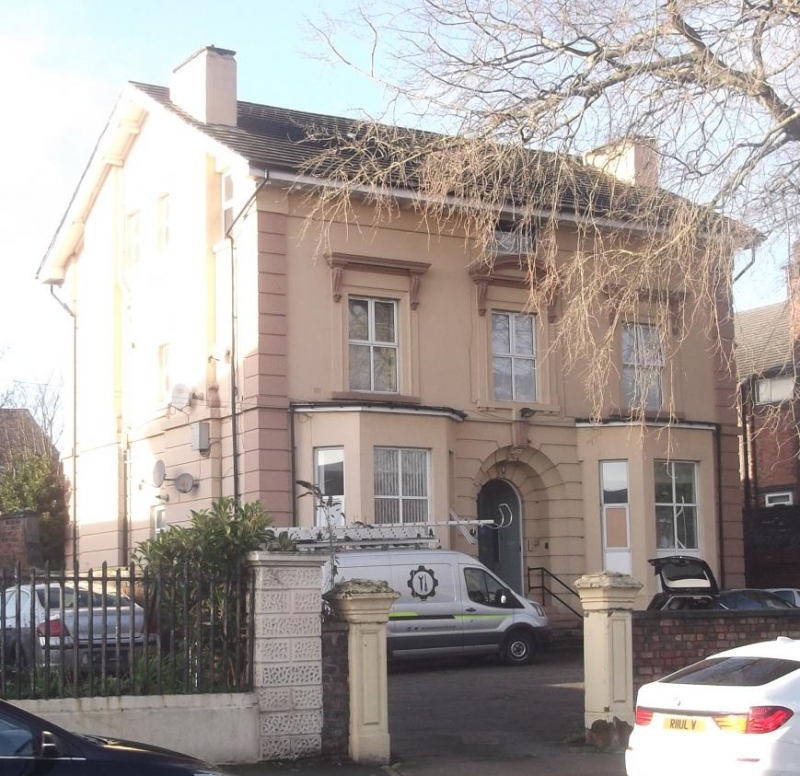
SJ 3791 LAUREL ROAD
L6
24/681 No. 4
-
G.V. II
House. 1860's. Stucco with slate roof. 2 storeys and 3
bays. Ground floor has channelled rustication, 1st floor
sill band, quoin strips and deep boxed eaves on brackets.
Ground floor has canted bay windows, cornice removed, and
casements. 1st floor windows have architraves, friezes and
consoled cornices, that to centre with segmental pediment;
casements. Central round-headed entrance has hollow chamfer
and keystone. Included for group value.
Listing NGR: SJ3774391095
External links are from the relevant listing authority and, where applicable, Wikidata. Wikidata IDs may be related buildings as well as this specific building. If you want to add or update a link, you will need to do so by editing the Wikidata entry.


Other nearby listed buildings
