Latitude: 54.2331 / 54°13'59"N
Longitude: -1.3429 / 1°20'34"W
OS Eastings: 442932
OS Northings: 482127
OS Grid: SE429821
Mapcode National: GBR MM2H.2B
Mapcode Global: WHD8H.BVSR
Plus Code: 9C6W6MM4+6V
Entry Name: The Royal Public House
Listing Date: 15 June 1984
Grade: II
Source: Historic England
Source ID: 1293655
English Heritage Legacy ID: 333319
Also known as: Royal
The Royal, Thirsk
ID on this website: 101293655
Location: Thirsk, North Yorkshire, YO7
County: North Yorkshire
District: Hambleton
Civil Parish: Thirsk
Built-Up Area: Thirsk
Traditional County: Yorkshire
Lieutenancy Area (Ceremonial County): North Yorkshire
Tagged with: Pub
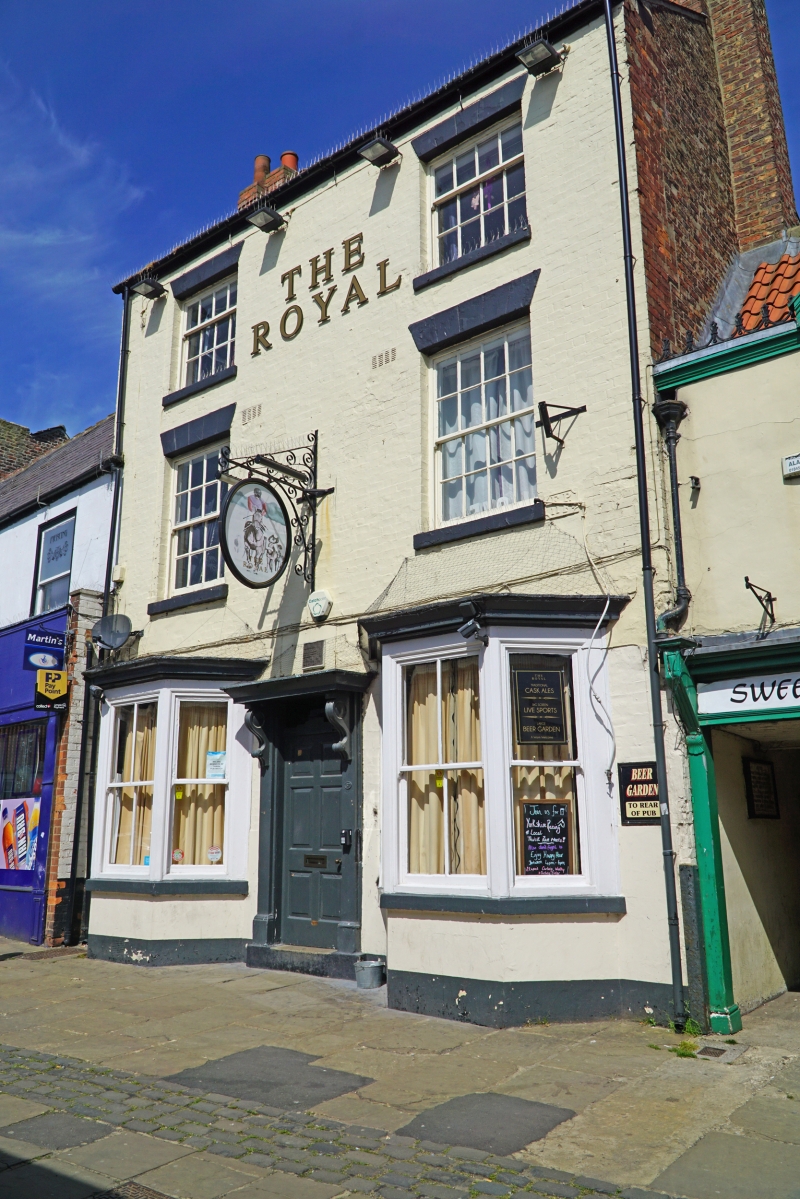
SE 4282-4382 THIRSK MARKET PLACE
6/78 (north side)
GV No 57 (The Royal Public
House)
II
Public House. Early C19. Brick, whitewashed; C20 slate roof. 3 storeys. 2 bays.
Later C19 wooden doorcase with brackets and 2 canted bays to ground floor. 16-pane
sash windows to the 1st floor and unequal sashes to the 2nd floor. C20 extension to
rear not of interest, Included partly for group value.
Listing NGR: SE4293282127
External links are from the relevant listing authority and, where applicable, Wikidata. Wikidata IDs may be related buildings as well as this specific building. If you want to add or update a link, you will need to do so by editing the Wikidata entry.


Other nearby listed buildings