Approximate Location Map
Large Map »
Latitude: 50.8733 / 50°52'23"N
Longitude: 0.0125 / 0°0'45"E
OS Eastings: 541695
OS Northings: 110129
OS Grid: TQ416101
Mapcode National: GBR KQ2.3ZK
Mapcode Global: FRA B6XS.NP6
Plus Code: 9F22V2F7+82
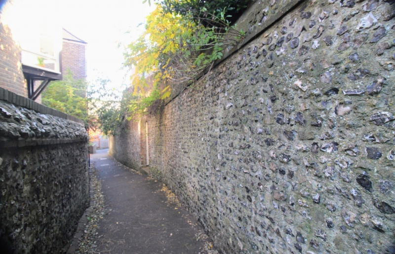
Entry Name: Wall on West Side of Brooman's Lane
Listing Date: 29 October 1985
Grade: II
Source: Historic England
Source ID: 1293897
English Heritage Legacy ID: 292986
ID on this website: 101293897
Location: Lewes, East Sussex, BN7
County: East Sussex
District: Lewes
Civil Parish: Lewes
Built-Up Area: Lewes
Traditional County: Sussex
Lieutenancy Area (Ceremonial County): East Sussex
Church of England Parish: Lewes St Thomas at Cliffe with Lewes All Saints
Church of England Diocese: Chichester
Tagged with: Wall
TQ 4110 SE LEWES BROOMAN'S LANE
10/15 (west side)
Wall on west side of Brooman's
Lane
GV II
Wall. C18, patched in C19 and C20. Flint with some red brick banding,
quoins and coping. 70 yards long and 10-12 feet high.
Listing NGR: TQ4169510129
External links are from the relevant listing authority and, where applicable, Wikidata. Wikidata IDs may be related buildings as well as this specific building. If you want to add or update a link, you will need to do so by editing the Wikidata entry.


Other nearby listed buildings
