Approximate Location Map
Large Map »
Latitude: 52.5119 / 52°30'42"N
Longitude: -2.6322 / 2°37'55"W
OS Eastings: 357194
OS Northings: 290629
OS Grid: SO571906
Mapcode National: GBR BP.GW49
Mapcode Global: VH83L.B4B7
Plus Code: 9C4VG969+P4
Entry Name: Manor Farm House
Listing Date: 1 February 1974
Grade: II
Source: Historic England
Source ID: 1294159
English Heritage Legacy ID: 254919
ID on this website: 101294159
Location: Stanton Long, Shropshire, TF13
County: Shropshire
Civil Parish: Stanton Long
Traditional County: Shropshire
Lieutenancy Area (Ceremonial County): Shropshire
Church of England Parish: Stanton Long
Church of England Diocese: Hereford
Tagged with: Farmhouse
1.
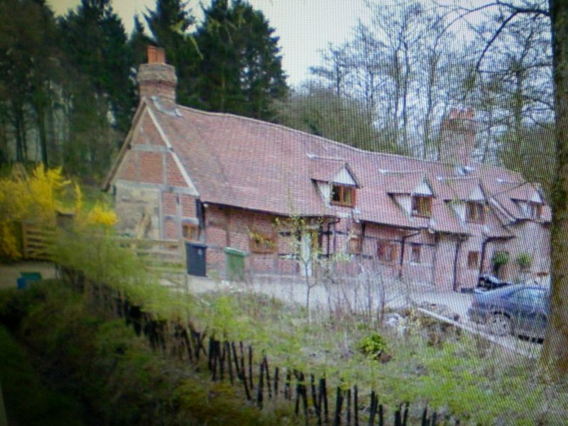
1954 STANTON LONG STANTON LONG
Manor Farm House
SO 59 SE 19/15
II
2.
C16 and later. Stone and brick with tiled roof; 1 storey plus attic and
2 storeys; brick stackes; casement windows. Wing on south side probably
early C19. Exposed ceiling beams.
Listing NGR: SO5719490629
External links are from the relevant listing authority and, where applicable, Wikidata. Wikidata IDs may be related buildings as well as this specific building. If you want to add or update a link, you will need to do so by editing the Wikidata entry.


Other nearby listed buildings
