Latitude: 54.4682 / 54°28'5"N
Longitude: -1.1893 / 1°11'21"W
OS Eastings: 452638
OS Northings: 508395
OS Grid: NZ526083
Mapcode National: GBR NJ4S.91
Mapcode Global: WHD7D.PYVH
Plus Code: 9C6WFR96+77
Entry Name: The Old Rectory
Listing Date: 5 May 1952
Grade: II*
Source: Historic England
Source ID: 1294334
English Heritage Legacy ID: 331995
ID on this website: 101294334
Location: Stokesley, North Yorkshire, TS9
County: North Yorkshire
District: Hambleton
Civil Parish: Stokesley
Built-Up Area: Stokesley
Traditional County: Yorkshire
Lieutenancy Area (Ceremonial County): North Yorkshire
Church of England Parish: Stokesley with Seamer-in-Cleveland
Church of England Diocese: York
Tagged with: Clergy house
NZ 5208 SE STOKESLEY LEVENSIDE 13/112 (south side)
No 7 (The Old Rectory)
II*
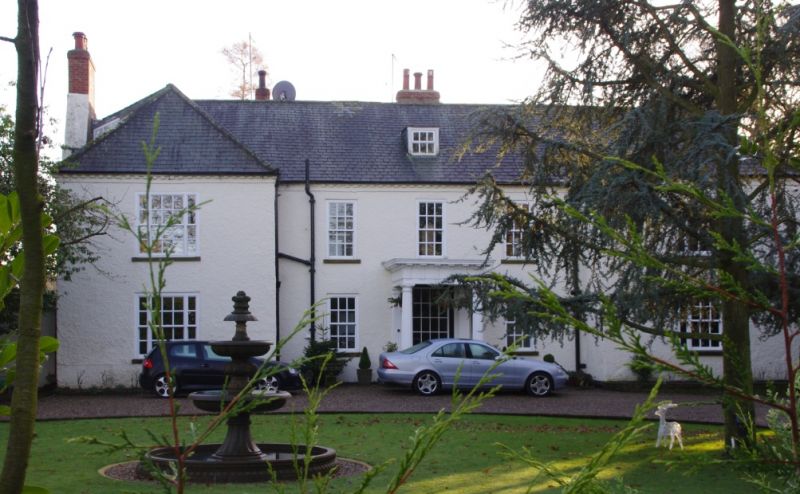
Early C18 with later C18 additions. Pebbledash, probably on stone. Fairly low pitched hipped roofs of graduated Welsh slates. Lakeland, Slates in front. Two parallel, longitudal central ranges flanked by transverse wings later extended into bows on south front. End and off-centre chimneys. Two storeys. Three window centre and one window wing projections, all C18 sashes with glazing bars, those in wings tripartite on entrance front. On garden front early C19 sashes in bows. One central dormer. Added Roman Doric porch. Interior shows staircase with closed string, some C18 cornices, much early C19 woodwork and a first floor room, with gallery at one end, raised dais at other, said to have been adapted to function as ecclesiastical court.
Listing NGR: NZ5263808395
External links are from the relevant listing authority and, where applicable, Wikidata. Wikidata IDs may be related buildings as well as this specific building. If you want to add or update a link, you will need to do so by editing the Wikidata entry.


Other nearby listed buildings