Approximate Location Map
Large Map »
Latitude: 51.4557 / 51°27'20"N
Longitude: 0.1301 / 0°7'48"E
OS Eastings: 548091
OS Northings: 175124
OS Grid: TQ480751
Mapcode National: GBR R4.1GC
Mapcode Global: VHHNS.6NMX
Plus Code: 9F32F44J+72
Entry Name: Street Wall and Gateway to North of Red House
Listing Date: 17 December 1980
Grade: II
Source: Historic England
Source ID: 1294702
English Heritage Legacy ID: 198716
ID on this website: 101294702
Location: Bexley, London, DA6
County: London
District: Bexley
Electoral Ward/Division: Christchurch
Parish: Non Civil Parish
Built-Up Area: Bexley
Traditional County: Kent
Lieutenancy Area (Ceremonial County): Greater London
Church of England Parish: Bexleyheath Christ Church
Church of England Diocese: Rochester
Tagged with: Wall
RED HOUSE LANE
1.
5005
Bexleyheath
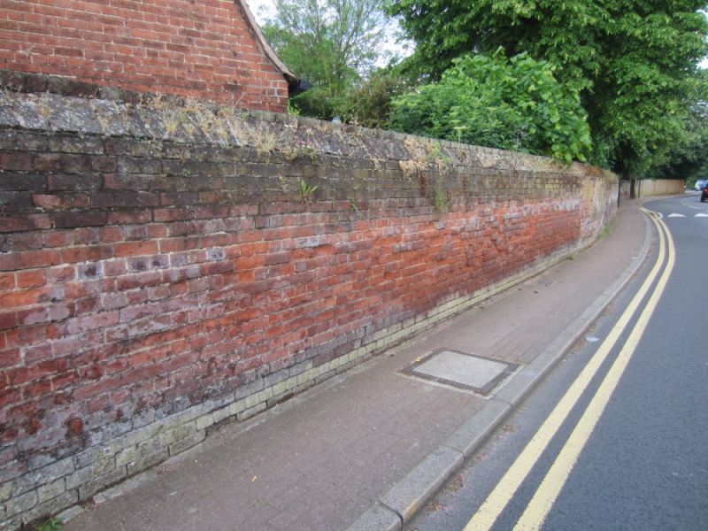
Street wall and gateway
to north of Red House
TQ 4875 8/6B
II GV
2.
1859. By Philip Webb. Red brick wall along street frontage. About 7 feet
high, with moulded coping. Plain gateway, with wooden gates.
Listing NGR: TQ4809175124
External links are from the relevant listing authority and, where applicable, Wikidata. Wikidata IDs may be related buildings as well as this specific building. If you want to add or update a link, you will need to do so by editing the Wikidata entry.


Other nearby listed buildings
