Latitude: 51.2429 / 51°14'34"N
Longitude: -0.0571 / 0°3'25"W
OS Eastings: 535710
OS Northings: 151096
OS Grid: TQ357510
Mapcode National: GBR KKJ.4C1
Mapcode Global: VHGSC.Y1N0
Plus Code: 9C3X6WVV+54
Entry Name: The Old Packhouse
Listing Date: 11 June 1958
Grade: II*
Source: Historic England
Source ID: 1294724
English Heritage Legacy ID: 287737
ID on this website: 101294724
Location: Church Town, Tandridge, Surrey, RH9
County: Surrey
District: Tandridge
Civil Parish: Godstone
Traditional County: Surrey
Lieutenancy Area (Ceremonial County): Surrey
Church of England Parish: Godstone and Blindley Heath
Church of England Diocese: Southwark
Tagged with: Architectural structure
TQ 35SE GODSTONE C.P. CHURCH LANE GODSTONE 6/76 The Old Packhouse 11.6.58 II*
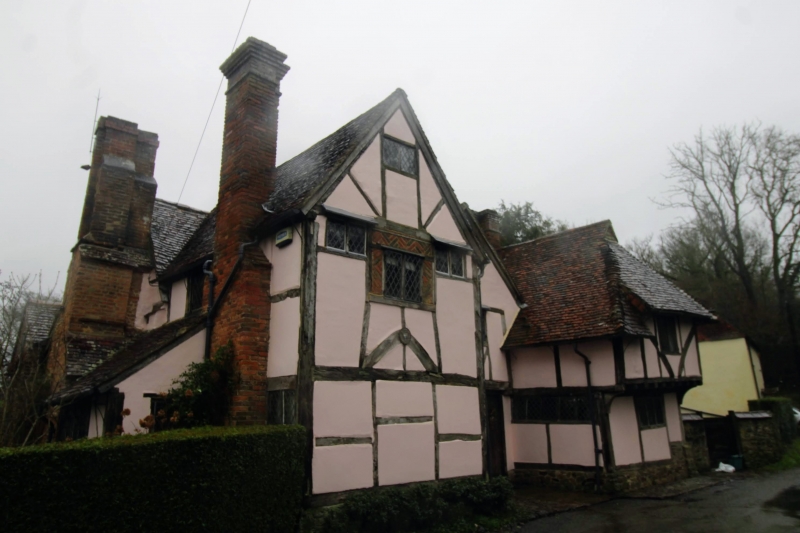
House. Early C15 hall house with wing to south added in late C16, restored in C19 and C20. Timber framed, on rubblestone plinth with whitewashed, rendered infill; plain tiled roofs, half hipped with end gablets on range to right. End stack to left, ridge stack to centre of right hand range and large, offset stack to rear left. L shaped with wing to rear right. Two storeys, originally four bay hall house with two bay gable front wing to front left and projecting wing to right with first floor jettied on corner brackets; extensive curved bracing visible. C19 diamond pattern, leaded, casements, diamond shaped wooden mullions to first floor window on left side of right hand wing. Planked door to right end of recessed centre bays. Pentice roof addition--to right set back with dormer above. Interior: Extensive timber framing visible. Traces of service door openings remain. Square crown post with enlarged square base and double collar roof.
Listing NGR: TQ3571051096
External links are from the relevant listing authority and, where applicable, Wikidata. Wikidata IDs may be related buildings as well as this specific building. If you want to add or update a link, you will need to do so by editing the Wikidata entry.


Other nearby listed buildings