Approximate Location Map
Large Map »
Latitude: 52.7693 / 52°46'9"N
Longitude: -2.3796 / 2°22'46"W
OS Eastings: 374484
OS Northings: 319146
OS Grid: SJ744191
Mapcode National: GBR 7Z.YQHF
Mapcode Global: WH9CR.FN2B
Plus Code: 9C4VQJ9C+P5
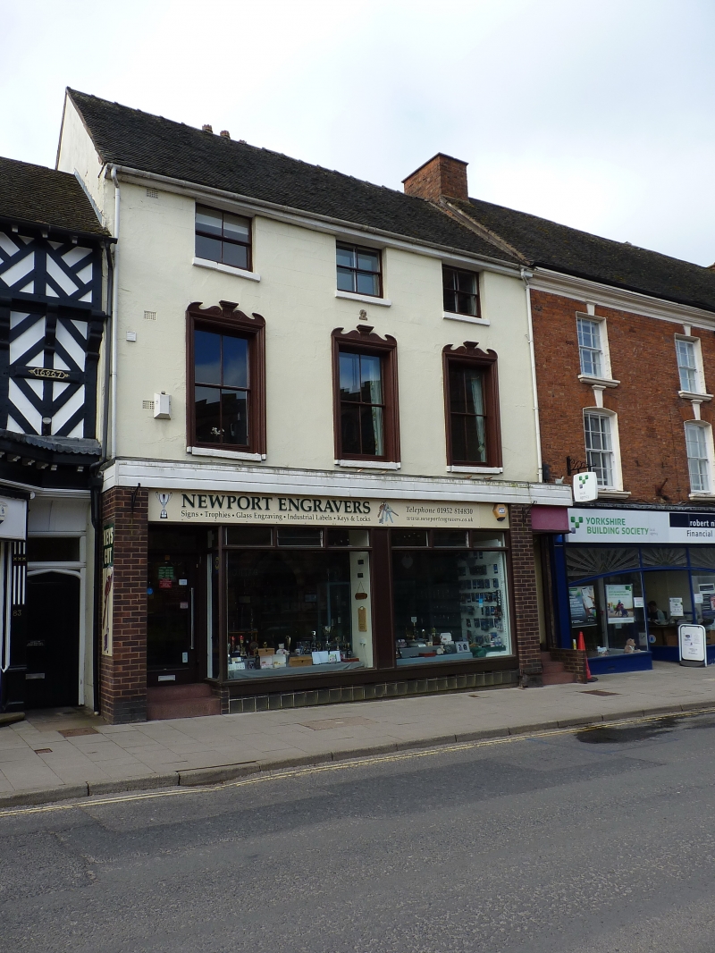
Entry Name: 85, High Street
Listing Date: 29 June 1978
Grade: II
Source: Historic England
Source ID: 1295296
English Heritage Legacy ID: 255385
ID on this website: 101295296
Location: Newport, Telford and Wrekin, Shropshire, TF10
County: Telford and Wrekin
Civil Parish: Newport
Built-Up Area: Newport
Traditional County: Shropshire
Lieutenancy Area (Ceremonial County): Shropshire
Church of England Parish: Newport St Nicholas
Church of England Diocese: Lichfield
Tagged with: Building
HIGH STREET
1.
5362
(West Side)
No 85
SJ 7419 SW 1/87
II GV
2.
C18 with mid C19 stuccoed facade. 2 storeys plus attic; 3 sash windows (single
glazing bars only) in moulded architraves; plain eaves; tiles. Included for
group value.
Listing NGR: SJ7448419146
External links are from the relevant listing authority and, where applicable, Wikidata. Wikidata IDs may be related buildings as well as this specific building. If you want to add or update a link, you will need to do so by editing the Wikidata entry.


Other nearby listed buildings
