Latitude: 51.1584 / 51°9'30"N
Longitude: 0.5533 / 0°33'11"E
OS Eastings: 578641
OS Northings: 143005
OS Grid: TQ786430
Mapcode National: GBR PSM.8QK
Mapcode Global: VHJN0.J4VS
Plus Code: 9F325H53+98
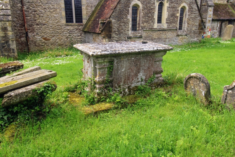
Entry Name: Monument About 10 Metres North of Nave of Church of All Saints
Listing Date: 25 March 1987
Grade: II
Source: Historic England
Source ID: 1298855
English Heritage Legacy ID: 174585
ID on this website: 101298855
Location: All Saints' Church, Staplehurst, Maidstone, Kent, TN12
County: Kent
District: Maidstone
Civil Parish: Staplehurst
Built-Up Area: Staplehurst
Traditional County: Kent
Lieutenancy Area (Ceremonial County): Kent
Tagged with: Monument
STAPLEHURST HIGH STREET TQ 74 SE (East side)
3/118 Monument about 10 metres north of nave of Church of All Saints
GV II
Chest tomb. C18. Stone, on stone base, with moulded plinth and cornice, gadrooned side pilasters, and fielded inscription panel with concave corners. Inscription illegible at time of re-survey.
Listing NGR: TQ7857343021
External links are from the relevant listing authority and, where applicable, Wikidata. Wikidata IDs may be related buildings as well as this specific building. If you want to add or update a link, you will need to do so by editing the Wikidata entry.


Other nearby listed buildings