Latitude: 51.4187 / 51°25'7"N
Longitude: 0.0962 / 0°5'46"E
OS Eastings: 545851
OS Northings: 170938
OS Grid: TQ458709
Mapcode National: GBR PJ.BXF
Mapcode Global: VHHNY.ML6S
Plus Code: 9F32C39W+FF
Entry Name: The Thatch
Listing Date: 29 June 1973
Grade: II
Source: Historic England
Source ID: 1299042
English Heritage Legacy ID: 358548
ID on this website: 101299042
Location: Bromley, London, BR7
County: London
District: Bromley
Electoral Ward/Division: Chislehurst
Parish: Non Civil Parish
Built-Up Area: Bromley
Traditional County: Kent
Lieutenancy Area (Ceremonial County): Greater London
Church of England Parish: Chislehurst St Nicholas
Church of England Diocese: Rochester
Tagged with: Architectural structure Thatched cottage
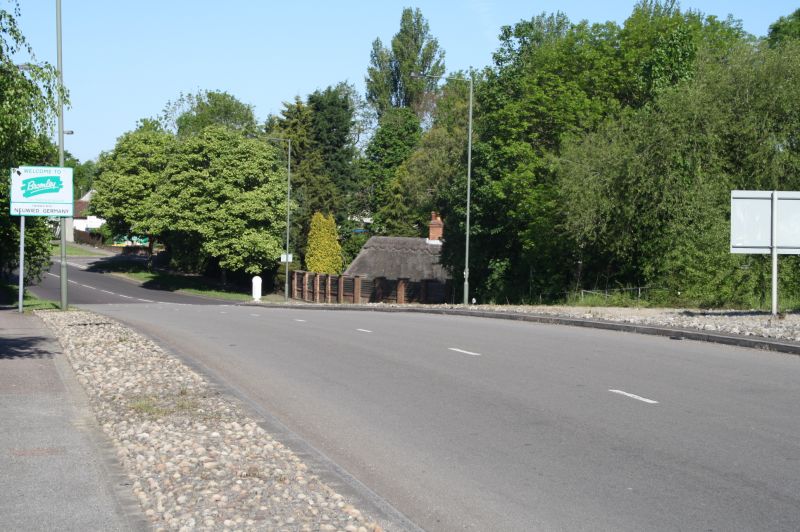
FERRY STREET, CHISLEHURST
1.
4407 (North West Side)
The Thatch
TQ 47 SE 7/83
II
2.
C19, 1 storey. Painted brick with thatched roof. 5 windows with
jalousies. 2 panelled doors. Plinth.
Listing NGR: TQ4585170938
External links are from the relevant listing authority and, where applicable, Wikidata. Wikidata IDs may be related buildings as well as this specific building. If you want to add or update a link, you will need to do so by editing the Wikidata entry.


Other nearby listed buildings