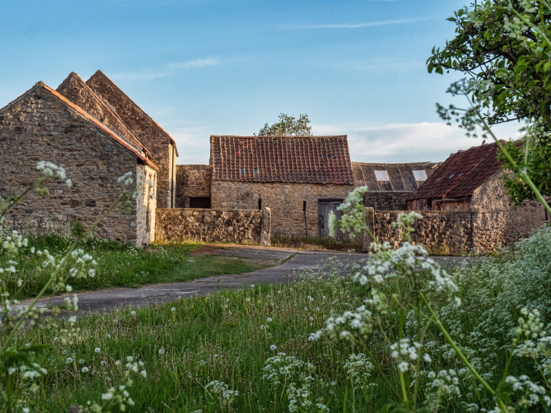
Latitude: 54.5794 / 54°34'45"N
Longitude: -1.5604 / 1°33'37"W
OS Eastings: 428514
OS Northings: 520555
OS Grid: NZ285205
Mapcode National: GBR KHJH.Z5
Mapcode Global: WHC5Q.0576
Plus Code: 9C6WHCHQ+QV
Entry Name: Farmbuildings to North West of Coatham Hall Farmhouse
Listing Date: 16 July 1986
Last Amended: 28 January 1987
Grade: II
Source: Historic England
Source ID: 1299334
English Heritage Legacy ID: 110757
ID on this website: 101299334
Location: Coatham Mundeville, Darlington, County Durham, DL3
County: Darlington
Civil Parish: Coatham Mundeville
Traditional County: Durham
Lieutenancy Area (Ceremonial County): County Durham
Church of England Parish: Great Aycliffe
Church of England Diocese: Durham
Tagged with: Agricultural structure
In the entry for: NZ 2820 COATHAM MUNDEVILLE COATHAM LANE 12/168 (north side) Farmbuildings to north- west of Coatham Farmhouse GV II The address shall be amended to read: COATHAM LANE (north side) Farmbuildings to north- west of Coatham Hall Farmhouse
------------------------------------
NZ 2820 COATHAM MUNDEVILLE COATHAM LANE (North side) 12/168 farmbuildings to north-west of Coatham Farmhouse GV II Farmbuildings. Late C18 and early C19. Coursed rubble; pantiled and corrugated asbestos roofs. U-plan with range extending beyond right rear corner. Farmbuildings described from front left in clockwise direction: Single-storey, 3-bay former stable with boarded door, flanking hit-and-miss windows and pantiled roof; Tall single-storey, one-bay shed/loose-box with replaced boarded door, hit-and- miss window and steeply-pitched pantiled roof; 2-storey, 4-bay barn with boarded door, 2 rows of flanking breathers and steeply-pitched asbestos roof; Tall single-storey barn, at right-angles, with altered openings and pantiled roof; Long single-storey range, with dressed sandstone face to yard extending to right, has altered openings, breathers, segmental brick arches (some blocked), corrugated asbestos and pantiled roof; Long single-storey former range of byres (attached at right-angles to centre of previous range) with altered openings and steeply-pitched pantiled roof; pigeon holes and ledges on front gable. Attached C20 weather-boarded shelter shed across yard and later wood farmbuildings on right and rear are not of special interest. Included for group value.
Listing NGR: NZ2851420555
External links are from the relevant listing authority and, where applicable, Wikidata. Wikidata IDs may be related buildings as well as this specific building. If you want to add or update a link, you will need to do so by editing the Wikidata entry.


Other nearby listed buildings