Latitude: 52.5779 / 52°34'40"N
Longitude: -1.5465 / 1°32'47"W
OS Eastings: 430825
OS Northings: 297885
OS Grid: SP308978
Mapcode National: GBR 5HP.CT3
Mapcode Global: WHCHD.6GTK
Plus Code: 9C4WHFH3+59
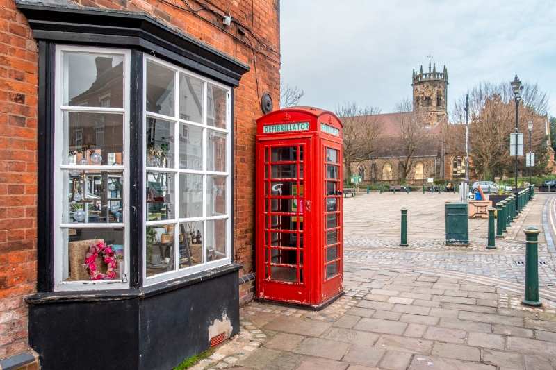
Entry Name: K6 Telephone Kiosk
Listing Date: 26 August 1987
Grade: II
Source: Historic England
Source ID: 1299788
English Heritage Legacy ID: 309156
ID on this website: 101299788
Location: Atherstone, North Warwickshire, CV9
County: Warwickshire
District: North Warwickshire
Civil Parish: Atherstone
Built-Up Area: Atherstone
Traditional County: Warwickshire
Lieutenancy Area (Ceremonial County): Warwickshire
Church of England Parish: Atherstone St Mary
Church of England Diocese: Coventry
Tagged with: K6 telephone box
ATHERSTONE MARKET STREET SP3097 9/100 K6 Telephone Kiosk 26/08/87 GV II Telephone kiosk, type K6. Designed 1935 by Sir Giles Gilbert Scott. Made by various contractors. Cast iron. Square kiosk with domed roof. Unperforated crowns to top panels and margin glazing to windows and door.
Listing NGR: SP3082597885
External links are from the relevant listing authority and, where applicable, Wikidata. Wikidata IDs may be related buildings as well as this specific building. If you want to add or update a link, you will need to do so by editing the Wikidata entry.


Other nearby listed buildings