Latitude: 53.3571 / 53°21'25"N
Longitude: -2.9945 / 2°59'40"W
OS Eastings: 333905
OS Northings: 384929
OS Grid: SJ339849
Mapcode National: GBR 7YJM.H9
Mapcode Global: WH87D.ZW68
Plus Code: 9C5V9244+R5
Entry Name: 192-198, New Chester Road
Listing Date: 20 December 1965
Grade: II
Source: Historic England
Source ID: 1299913
English Heritage Legacy ID: 215501
ID on this website: 101299913
Location: New Ferry, Wirral, Merseyside, CH62
County: Wirral
Electoral Ward/Division: Bromborough
Parish: Non Civil Parish
Built-Up Area: Bebington
Traditional County: Cheshire
Lieutenancy Area (Ceremonial County): Merseyside
Church of England Parish: New Ferry St Mark
Church of England Diocese: Chester
Tagged with: Building
BEBINGTON NEW CHESTER ROAD SJ 3385 NE (west side) Port Sunlight 13/174 Nos. 192 to 198 20.12.65 (even)
G.V. II
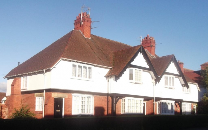
Terrace of 4 houses. 1899. By Grayson and Ould. Brick with plaster 1st floor and hipped tile roof. 2 storeys, 4 bays, central bays have jettied 1st floors under gables. Timber band over ground floor, central bays on bressumer on braced posts have gables jettied over windows and enriched bargeboards. Ground floor windows have small-paned casements; central 4-light rectangular bay windows and end canted 4-light oriels. 1st floor windows have leaded casements of 4-lights, central canted oriels and end windows in architraves. Entrances have chamfered stone lintels and plank doors with 3 lights. 2 cross-axial stacks. Rear similar, privies.
Listing NGR: SJ3390584929
External links are from the relevant listing authority and, where applicable, Wikidata. Wikidata IDs may be related buildings as well as this specific building. If you want to add or update a link, you will need to do so by editing the Wikidata entry.


Other nearby listed buildings