Approximate Location Map
Large Map »
Latitude: 51.4091 / 51°24'32"N
Longitude: -0.3048 / 0°18'17"W
OS Eastings: 517997
OS Northings: 169150
OS Grid: TQ179691
Mapcode National: GBR 78.ZTP
Mapcode Global: VHGR8.NVQ4
Plus Code: 9C3XCM5W+J3
Entry Name: United Reformed Church
Listing Date: 6 October 1983
Grade: II
Source: Historic England
Source ID: 1300202
English Heritage Legacy ID: 203108
Also known as: United Reformed Church, Kingston upon Thames
ID on this website: 101300202
Location: Kingston upon Thames, London, KT1
County: London
District: Kingston upon Thames
Electoral Ward/Division: Grove
Parish: Non Civil Parish
Built-Up Area: Kingston upon Thames
Traditional County: Surrey
Lieutenancy Area (Ceremonial County): Greater London
Church of England Parish: All Saints, Kingston-on-Thames
Church of England Diocese: Southwark
Tagged with: Church building
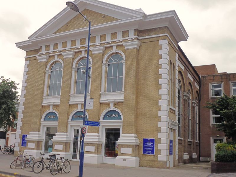
United Reformed Church 1856. Pedimented tetrastyle front with giant order of Roman Doric pilasters and short wings set back to each side. Pale brick with stucco mouldings and stucco quoins to the wings. The pilasters frame two storeys of round-arched openings. On the ground floor are three doorways with modern doors and blue mosaic in the tympanums of no interest. Above are round-arched windows with stuccoed pilasters and archivolts. Three bay return elevation to either side; arched windows, set in arched recesses with pilasters between. Parapet.
Listing NGR: TQ1799769150
This list entry was subject to a Minor Amendment on 16/02/2016
Kingston upon Thames, historically in Surrey, was an important market town, port and river crossing from the early medieval period, while there is evidence of Saxon settlement and of activity dating from the prehistoric period and of Roman occupation. It is close to the important historic royal estates at Hampton Court, Bushy Park, Richmond and Richmond Park. The old core of the town, around All Saints Church (C14 and C15, on an earlier site) and Market Place, with its recognisably medieval street pattern, is ‘the best preserved of its type in outer London’ (Pevsner and Cherry, London: South, 1983 p. 307). Kingston thrived first as an agricultural and market town and on its historic industries of malting, brewing and tanning, salmon fishing and timber exporting, before expanding rapidly as a suburb after the arrival of the railway in the 1860s. In the later C19 it become a centre of local government, and in the early C20 became an important shopping and commercial centre. Its rich diversity of buildings and structures from all periods reflect the multi-facetted development of the town.
External links are from the relevant listing authority and, where applicable, Wikidata. Wikidata IDs may be related buildings as well as this specific building. If you want to add or update a link, you will need to do so by editing the Wikidata entry.


Other nearby listed buildings
