Latitude: 51.9818 / 51°58'54"N
Longitude: -1.292 / 1°17'31"W
OS Eastings: 448720
OS Northings: 231713
OS Grid: SP487317
Mapcode National: GBR 7TV.Q55
Mapcode Global: VHCWN.KGB4
Plus Code: 9C3WXPJ5+P5
Entry Name: Home Farmhouse and Attached Farm Building Range
Listing Date: 5 May 1988
Grade: II
Source: Historic England
Source ID: 1300882
English Heritage Legacy ID: 243860
ID on this website: 101300882
Location: Clifton, Cherwell, Oxfordshire, OX15
County: Oxfordshire
District: Cherwell
Civil Parish: Deddington
Traditional County: Oxfordshire
Lieutenancy Area (Ceremonial County): Oxfordshire
Church of England Parish: Deddington
Church of England Diocese: Oxford
Tagged with: Farmhouse
SP43SE DEDDINGTON B403l (South side) Clifton 3/136 Home Farmhouse and attached farmbuilding range
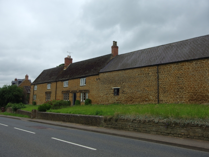
II Farmhouse and farmbuildings. Early C18, altered C19. Coursed squared marlstone with some wooden lintels and some ashlar dressings; concrete plain-tile and Welsh-slate roofs with stone-and-brick stacks. 4-unit plan plus farmbuilding range. 2 storeys. 4-window front has renewed 3-light casements at first floor, but at ground floor has three 3-light C19 stone-mullioned windows with labels plus, to extreme left, a flat-arched window with renewed casement. Windows in bays 3 and 4 are linked by a continuous label to a doorway between them; further blocked doorway with a rubble flat arch between bays one and 2. Steep-pitched roof has a central rubble-based stack plus a brick gable-stack to right. Rear has renewed casements with wooden lintels. Interior: chamfered beams; large chimneybreasts. Long slated farmbuilding range to right in 2 builds, is probably early C18 and Cl9; it has stable and loft doors to rear.
Listing NGR: SP4872031713
External links are from the relevant listing authority and, where applicable, Wikidata. Wikidata IDs may be related buildings as well as this specific building. If you want to add or update a link, you will need to do so by editing the Wikidata entry.


Other nearby listed buildings