Latitude: 51.9701 / 51°58'12"N
Longitude: -2.8106 / 2°48'38"W
OS Eastings: 344412
OS Northings: 230489
OS Grid: SO444304
Mapcode National: GBR FG.L1GK
Mapcode Global: VH78K.7RJ3
Plus Code: 9C3VX5CQ+2Q
Entry Name: Kilpeck Castle
Listing Date: 20 May 1987
Grade: II
Source: Historic England
Source ID: 1301419
English Heritage Legacy ID: 155573
ID on this website: 101301419
Location: Kilpeck, County of Herefordshire, HR2
County: County of Herefordshire
Civil Parish: Kilpeck
Traditional County: Herefordshire
Lieutenancy Area (Ceremonial County): Herefordshire
Church of England Parish: Kilpeck
Church of England Diocese: Hereford
KILPECK CP KILPECK SO 43 SW 2/39 Kilpeck Castle
GV II
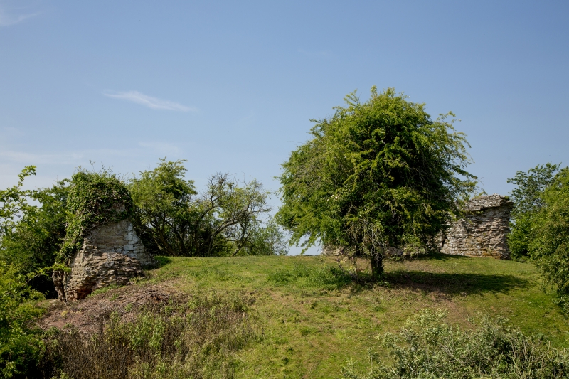
Ruins of C12 keep with motte and bailey earthworks. Two sandstone rubble sections of walling remain to north and to south-west, the north fragment has the recess of a fireplace and there appears to be the recess of a circlar oven in the south-western fragment. The motte and bailey earth- works are not included in this list. Ancient Monument No 17). (RCHM, Vol I, p 158).
Listing NGR: SO4440230485


Other nearby listed buildings