Approximate Location Map
Large Map »
Latitude: 51.4026 / 51°24'9"N
Longitude: -1.2597 / 1°15'34"W
OS Eastings: 451592
OS Northings: 167325
OS Grid: SU515673
Mapcode National: GBR 93D.0BZ
Mapcode Global: VHCZL.30WL
Plus Code: 9C3WCP3R+24
Entry Name: Monks Chambers
Listing Date: 10 November 1983
Grade: II
Source: Historic England
Source ID: 1303149
English Heritage Legacy ID: 39634
ID on this website: 101303149
Location: Thatcham, West Berkshire, RG19
County: West Berkshire
Civil Parish: Thatcham
Built-Up Area: Thatcham
Traditional County: Berkshire
Lieutenancy Area (Ceremonial County): Berkshire
Church of England Parish: Thatcham
Church of England Diocese: Oxford
Tagged with: Building
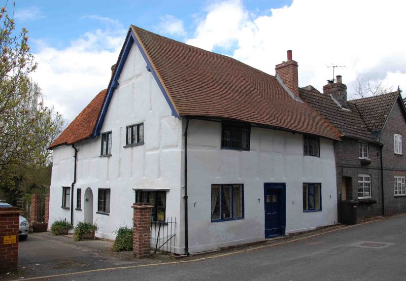
THATCHAM CHURCH LANE (west side)
SU 5167
8/21 No. 4
(Monks Chambers)
GV II
House. C16-17. Timber framed and rendered with old tile roof and end stack to
right. 2 storeys; 2 window front, leaded casements with boarded shutters on ground
floor. Central panelled door in old wooden surround.
Listing NGR: SU5159267325
External links are from the relevant listing authority and, where applicable, Wikidata. Wikidata IDs may be related buildings as well as this specific building. If you want to add or update a link, you will need to do so by editing the Wikidata entry.


Other nearby listed buildings
