Latitude: 54.9523 / 54°57'8"N
Longitude: -1.9204 / 1°55'13"W
OS Eastings: 405196
OS Northings: 561966
OS Grid: NZ051619
Mapcode National: GBR HC15.1J
Mapcode Global: WHB2G.GSRC
Plus Code: 9C6WX32H+WR
Entry Name: Bywell Bridge over River Tyne (That Part in Bywell Parish)
Listing Date: 24 May 1988
Grade: II
Source: Historic England
Source ID: 1303849
English Heritage Legacy ID: 239817
ID on this website: 101303849
Location: Bywell, Northumberland, NE43
County: Northumberland
Civil Parish: Bywell
Traditional County: Northumberland
Lieutenancy Area (Ceremonial County): Northumberland
Church of England Parish: Bywell St Peter
Church of England Diocese: Newcastle
BYWELL B 6309 NZ 06 SE 11/56 Bywell Bridge over River Tyne (that part in Bywell Parish)
II
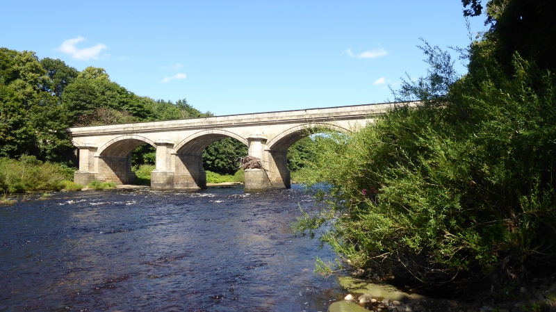
Bridge, 1836-8, by George Basevi. Ashlar, tooled except on parapet. 5 segmental moulded arches of equal height springing from hollow-chamfered imposts. Cutwaters with curved faces below bold roll moulding, upper parts triangular in plan with bold hollow-chamfered top cornice. Moulded cornice below parapet which has moulded plinth and cornice and a raised panel above each arch; similar internal face to parapet, segmental coping. Serpentine wing walls. 2 plainer flood arches, without parapet, on south.
Partly in the parish of Broomley and Stocksfield.
Listing NGR: NZ0519661966


Other nearby listed buildings