Latitude: 51.8214 / 51°49'16"N
Longitude: -1.6984 / 1°41'54"W
OS Eastings: 420884
OS Northings: 213683
OS Grid: SP208136
Mapcode National: GBR 4R8.PG6
Mapcode Global: VHBZR.HHZ2
Plus Code: 9C3WR8C2+HJ
Entry Name: 47, Great Barrington Village
Listing Date: 23 January 1952
Grade: II
Source: Historic England
Source ID: 1304955
English Heritage Legacy ID: 130800
ID on this website: 101304955
Location: Great Barrington, Cotswold, Gloucestershire, OX18
County: Gloucestershire
District: Cotswold
Civil Parish: Barrington
Traditional County: Gloucestershire
Lieutenancy Area (Ceremonial County): Gloucestershire
Church of England Parish: Great Barrington St Mary
Church of England Diocese: Gloucester
Tagged with: Building
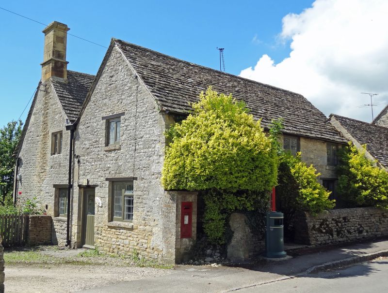
BARRINGTON GREAT BARRINGTON VILLAGE SP 2013-2113 (south side) 10/67 No 47 23.1.52 GV II House at the end of row. Mid-late C17 and C18-C19. Coursed squared and dressed limestone, stone slate roof with ashlar stacks. Two parallel rectangular ranges. Mid-late C17 range at rear. One and a half storeys with three C20 half dormers with 2-light casements to the upper floor. Three-light double-chamfered stone- mullioned casement with leaded panes lower left. Large C20 wooden casement with leaded panes lower right. Central C20 plank door. Two-light double-chamfered stone-mullioned casement with leaded panes in the first floor of the left gable end. Two-light C20 wooden casements with leaded panes to the ground floor. C19 range: Two storeys. 2-light wooden casements with leaded panes. Single- light with a double-chamfered stone surround with leaded panes. C19 plank door with a rectangular window pane at the top in left gable end (seen from road). Interior not inspected. (Barrington Park Estate).
Listing NGR: SP2088413683
External links are from the relevant listing authority and, where applicable, Wikidata. Wikidata IDs may be related buildings as well as this specific building. If you want to add or update a link, you will need to do so by editing the Wikidata entry.


Other nearby listed buildings