Latitude: 51.8771 / 51°52'37"N
Longitude: 0.5482 / 0°32'53"E
OS Eastings: 575502
OS Northings: 222908
OS Grid: TL755229
Mapcode National: GBR PHX.7FM
Mapcode Global: VHJJJ.G25T
Plus Code: 9F32VGGX+R7
Entry Name: 113 and 115, High Street
Listing Date: 25 October 1951
Grade: II
Source: Historic England
Source ID: 1305659
English Heritage Legacy ID: 113751
ID on this website: 101305659
Location: Braintree, Essex, CM7
County: Essex
District: Braintree
Electoral Ward/Division: Braintree Central & Beckers Green
Parish: Non Civil Parish
Built-Up Area: Braintree
Traditional County: Essex
Lieutenancy Area (Ceremonial County): Essex
Church of England Parish: Braintree St Michael
Church of England Diocese: Chelmsford
Tagged with: Building
HIGH STREET
1.
885
(North West Side)
BRIAINTREE
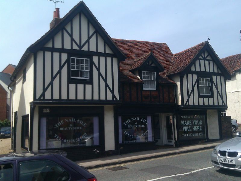
No 113 and 115
TL 7522 1/20 25.10.51.
II GV
2.
Probably a C15 timber-framed and plastered house with a central hall and jettied
gables at the south-east and north-west ends. An upper storey was inserted
in the central hall, probably in the C16 or C17. The front was heavily restored
in the C19 and is now pebbledashed, with sham timber-framing. 2 storeys and
attics, 3 window range, double-hung sashes with glazing bars in the upper sashes.
The centre part of the first storey has C19 ornamental terra-cotta tiles. The
ground storey has C20 shop windows. Roofs tiled, with the central window rising
to a gabled dormer. RCHM (25).
Nos 101 to 107 (odd) and Nos 113 to 117 (odd) form a group.
Listing NGR: TL7550222908
External links are from the relevant listing authority and, where applicable, Wikidata. Wikidata IDs may be related buildings as well as this specific building. If you want to add or update a link, you will need to do so by editing the Wikidata entry.


Other nearby listed buildings