Latitude: 51.7835 / 51°47'0"N
Longitude: 0.1457 / 0°8'44"E
OS Eastings: 548106
OS Northings: 211605
OS Grid: TL481116
Mapcode National: GBR LDK.1NJ
Mapcode Global: VHHM7.GFWM
Plus Code: 9F32Q4MW+C7
Entry Name: Almshouses
Listing Date: 5 February 1980
Grade: II
Source: Historic England
Source ID: 1306358
English Heritage Legacy ID: 119570
ID on this website: 101306358
Location: Churchgate Street, Harlow, Essex, CM17
County: Essex
District: Harlow
Electoral Ward/Division: Old Harlow
Parish: Non Civil Parish
Built-Up Area: Harlow
Traditional County: Essex
Lieutenancy Area (Ceremonial County): Essex
Church of England Parish: Harlow St Mary and St Hugh with St John the Baptist
Church of England Diocese: Chelmsford
Tagged with: Almshouse
1.
5216
TL 4811 NW
7/4
5.2.80
SHEERING ROAD
Almshouses
Nos 13 and 15
II
GV
2.
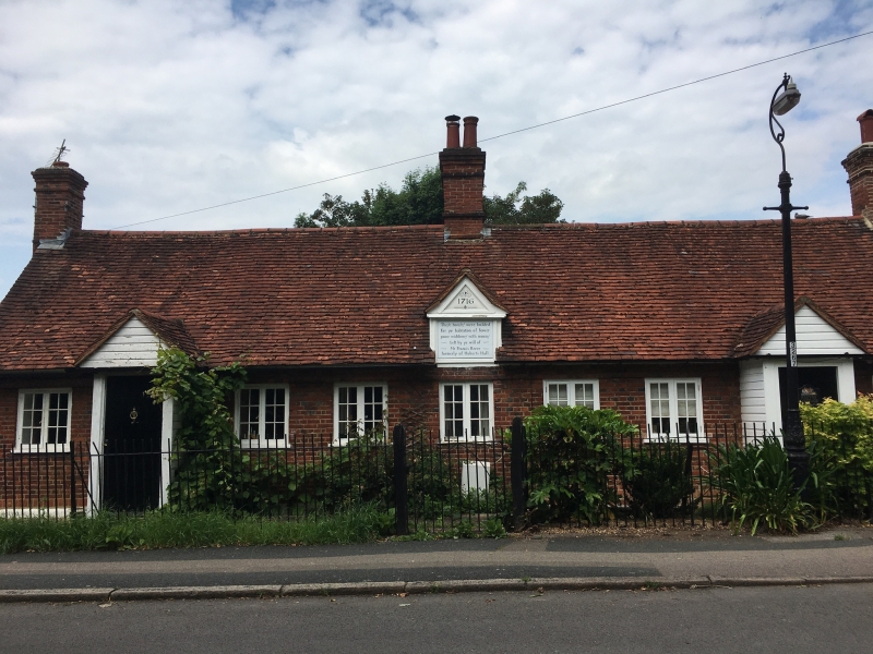
Dated 1716. A long range of one storey built in Flemish bonded red brick
with ridged and gabled peg-tile roof. Three red brick plain chimneys one
at the centre and one at each gable end. Two front doors in later gabled
porches and a range of 7 pairs of double 6 pane wooden casements. At the
centre-front a blind dormer with gable bears the inscription with date
and name of benefactor. Three course projecting eaves band. Inscribed:
'Thefe houfef were builded for ye habitation of fower poore widdowes with
monies left by ye will of Mr Francis Reeve formerly of Huberts Hall'.
These words on the front of a blind central dormer with a gable.
Listing NGR: TL4810611605
External links are from the relevant listing authority and, where applicable, Wikidata. Wikidata IDs may be related buildings as well as this specific building. If you want to add or update a link, you will need to do so by editing the Wikidata entry.


Other nearby listed buildings