Approximate Location Map
Large Map »
Latitude: 51.0109 / 51°0'39"N
Longitude: -3.4162 / 3°24'58"W
OS Eastings: 300744
OS Northings: 124452
OS Grid: ST007244
Mapcode National: GBR LM.JLC4
Mapcode Global: FRA 36QF.YQC
Plus Code: 9C3R2H6M+8G
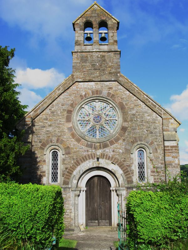
Entry Name: Churchyard Gate at Petton Chapel
Listing Date: 7 December 1987
Grade: II
Source: Historic England
Source ID: 1306761
English Heritage Legacy ID: 96701
ID on this website: 101306761
Location: St Petrock's Church, Petton, Mid Devon, EX16
County: Devon
District: Mid Devon
Civil Parish: Bampton
Traditional County: Devon
Lieutenancy Area (Ceremonial County): Devon
Church of England Parish: Petton
Church of England Diocese: Exeter
Tagged with: Church gate
ST 02 SW BAMPTON PETTON
7/57 Churchyard gate at Petton Chapel
-
GV II
Gate and standard. Probably 1848, co-eval with the rebuilding of Petton Chapel.
Cast iron. Square section standard with a pyramidal finial to a gate with spearhead
finials above the middle rail and fleur de lis finials above the top rail which rises
to left and right.
Listing NGR: ST0074424452
External links are from the relevant listing authority and, where applicable, Wikidata. Wikidata IDs may be related buildings as well as this specific building. If you want to add or update a link, you will need to do so by editing the Wikidata entry.


Other nearby listed buildings
