Latitude: 51.596 / 51°35'45"N
Longitude: 0.8049 / 0°48'17"E
OS Eastings: 594367
OS Northings: 192301
OS Grid: TQ943923
Mapcode National: GBR RQ6.SD7
Mapcode Global: VHKHG.W4VT
Plus Code: 9F32HRW3+CW
Entry Name: The Plough and Sail Inn
Listing Date: 22 June 1984
Grade: II
Source: Historic England
Source ID: 1307178
English Heritage Legacy ID: 123170
Also known as: Plough & Sail
Plough & Sail, Rochford
ID on this website: 101307178
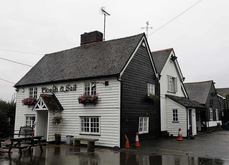
PAGLESHAM EAST END TQ 99 SW 7/167 The Plough and Sail Inn 22.6.84 GV II Public House. C17 or earlier with later alterations and additions. Timber framed and weatherboarded. Red plain tiled roof. Central red brick chimney stack. 2 storeys, one storey and attics rear range with 2 catslide dormers. 2 window range of small paned 2-light casements. Central C20 gabled porch and glazed door. There is a C20 flat roofed single storey extension to rear of left return. RCHM 6.
Listing NGR: TQ9436792301
External links are from the relevant listing authority and, where applicable, Wikidata. Wikidata IDs may be related buildings as well as this specific building. If you want to add or update a link, you will need to do so by editing the Wikidata entry.


Other nearby listed buildings