Approximate Location Map
Large Map »
Latitude: 51.9115 / 51°54'41"N
Longitude: -0.2086 / 0°12'30"W
OS Eastings: 523317
OS Northings: 225177
OS Grid: TL233251
Mapcode National: GBR J7W.22W
Mapcode Global: VHGP0.B6KZ
Plus Code: 9C3XWQ6R+HH
Entry Name: 70 and 72, High Street
Listing Date: 18 February 1948
Grade: II
Source: Historic England
Source ID: 1307806
English Heritage Legacy ID: 158070
ID on this website: 101307806
Location: Old Town, Stevenage, Hertfordshire, SG1
County: Hertfordshire
District: Stevenage
Electoral Ward/Division: Old Town
Parish: Non Civil Parish
Built-Up Area: Stevenage
Traditional County: Hertfordshire
Lieutenancy Area (Ceremonial County): Hertfordshire
Church of England Parish: Stevenage Holy Trinity
Church of England Diocese: St.Albans
Tagged with: Building
1.
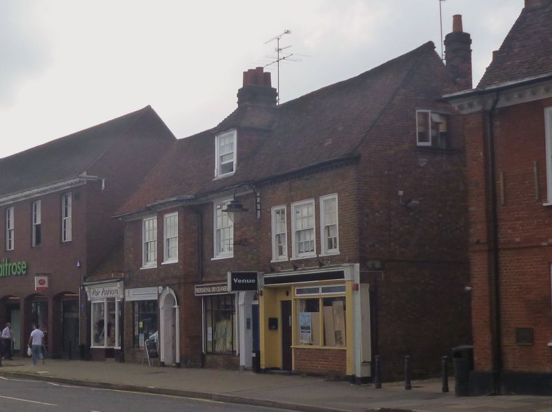
5257 HIGH STREET
(West Side)
-----------
Nos 70 and 72
TL 2325 SW 1/39 18.2.48.
II GV
2.
Late C17 or early C18. Red brick house now divided into 2 dwellings. Tiled roof
with gabled dormer. 2 storeys and attics, modillioned wooden cornice. Full height
canted bay has round arched doorway with fanlight in panelled reveal. Similar
doorway on right with 6 panel door. 3 nearly flush Windows on left, shop window
on right.
Nos 60 to 72 (even) and No 72A form a group.
Listing NGR: TL2331725177
External links are from the relevant listing authority and, where applicable, Wikidata. Wikidata IDs may be related buildings as well as this specific building. If you want to add or update a link, you will need to do so by editing the Wikidata entry.


Other nearby listed buildings
