Approximate Location Map
Large Map »
Latitude: 50.2426 / 50°14'33"N
Longitude: -5.2407 / 5°14'26"W
OS Eastings: 169032
OS Northings: 43098
OS Grid: SW690430
Mapcode National: GBR Z3.CSHR
Mapcode Global: VH12K.35TB
Plus Code: 9C2P6QV5+3P
Entry Name: Milepost at SW 690 430
Listing Date: 12 September 1989
Grade: II
Source: Historic England
Source ID: 1309870
English Heritage Legacy ID: 66841
ID on this website: 101309870
Location: Tolgus Mount, Cornwall, TR16
County: Cornwall
Civil Parish: Redruth
Traditional County: Cornwall
Lieutenancy Area (Ceremonial County): Cornwall
Church of England Parish: Treleigh
Church of England Diocese: Truro
Tagged with: Milestone
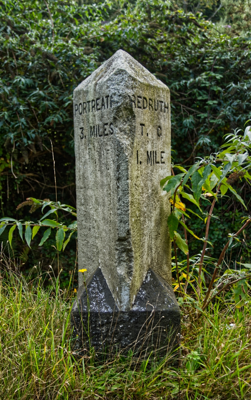
REDRUTH NEW PORTREATH ROAD
SW 64 SE
(west side)
5/281
Milepost at SW 690 430
II
Milepost. Probably late C19. Dressed granite. Triangular type, inscribed:-
PORTREATH REDRUTH
3 MILES 1 MILES
Listing NGR: SW6903243098
External links are from the relevant listing authority and, where applicable, Wikidata. Wikidata IDs may be related buildings as well as this specific building. If you want to add or update a link, you will need to do so by editing the Wikidata entry.


Other nearby listed buildings
