Latitude: 51.5722 / 51°34'20"N
Longitude: -0.8702 / 0°52'12"W
OS Eastings: 478392
OS Northings: 186534
OS Grid: SU783865
Mapcode National: GBR C4F.8T5
Mapcode Global: VHDW8.VRS3
Plus Code: 9C3XH4CH+VW
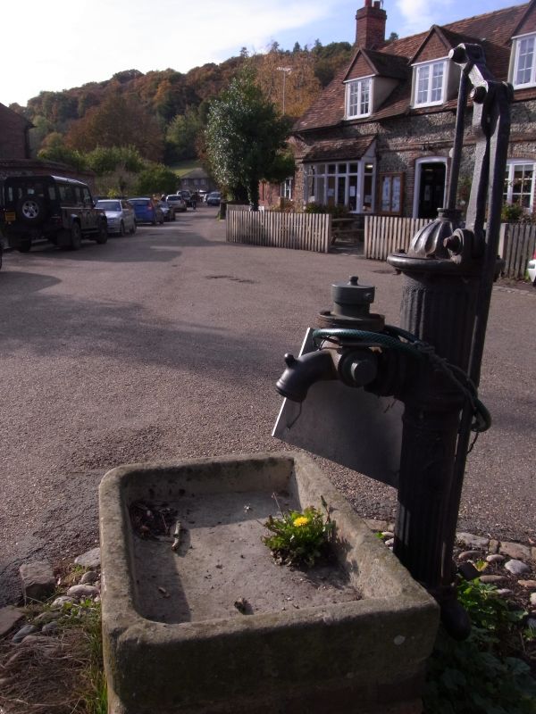
Entry Name: Waterpump 22 Metres to South of Lychgate
Listing Date: 22 January 1986
Grade: II
Source: Historic England
Source ID: 1310740
English Heritage Legacy ID: 46749
ID on this website: 101310740
Location: Hambleden, Buckinghamshire, RG9
County: Buckinghamshire
Civil Parish: Hambleden
Traditional County: Buckinghamshire
Lieutenancy Area (Ceremonial County): Buckinghamshire
Church of England Parish: Hambleden with Frieth
Church of England Diocese: Oxford
Tagged with: Water pump
SU 78 NE HAMBLEDEN HAMBLEDEN VILLAGE
6/97 Waterpump 22m. to S. of
lychgate
GV II
Water pump. Mid-late C19, Cast iron. Fluted. Complete with handle.
Plaque inscribed "E. Margrett, Reading". Included for group value.
Listing NGR: SU7839286534
External links are from the relevant listing authority and, where applicable, Wikidata. Wikidata IDs may be related buildings as well as this specific building. If you want to add or update a link, you will need to do so by editing the Wikidata entry.


Other nearby listed buildings