Approximate Location Map
Large Map »
Latitude: 51.6288 / 51°37'43"N
Longitude: -0.7489 / 0°44'56"W
OS Eastings: 486694
OS Northings: 192956
OS Grid: SU866929
Mapcode National: GBR D54.X1M
Mapcode Global: VHDW4.YBY7
Plus Code: 9C3XJ7H2+GC
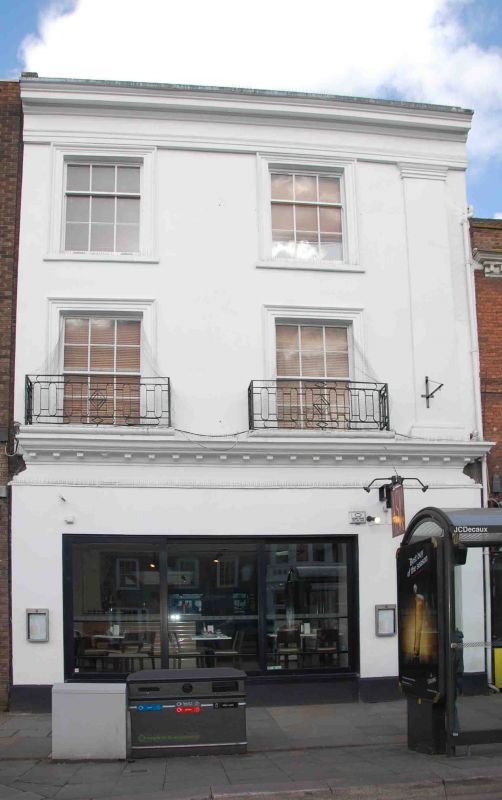
Entry Name: 17, High Street
Listing Date: 28 June 1973
Grade: II
Source: Historic England
Source ID: 1310773
English Heritage Legacy ID: 46044
ID on this website: 101310773
Location: High Wycombe, Buckinghamshire, HP11
County: Buckinghamshire
Electoral Ward/Division: Abbey
Parish: Non Civil Parish
Built-Up Area: High Wycombe
Traditional County: Buckinghamshire
Lieutenancy Area (Ceremonial County): Buckinghamshire
Church of England Parish: High Wycombe All Saints
Church of England Diocese: Oxford
Tagged with: Building
1.
963
SU 8692 NE
1/266
HIGH STREET
(North Side)
No 17
II
2.
Early C19. Stucco, parapet hiding roof. 3 storeys, modern shop window
with frieze, modillion cornice. Upper floor: Doric pilaster on right,
2 sashes with glazing bars in architrave surrounds, 1st floor cast iron
balconettes. Eaves level entablature.
Listing NGR: SU8669492956
External links are from the relevant listing authority and, where applicable, Wikidata. Wikidata IDs may be related buildings as well as this specific building. If you want to add or update a link, you will need to do so by editing the Wikidata entry.


Other nearby listed buildings
