Approximate Location Map
Large Map »
Latitude: 50.2261 / 50°13'33"N
Longitude: -5.3464 / 5°20'46"W
OS Eastings: 161415
OS Northings: 41587
OS Grid: SW614415
Mapcode National: GBR FX52.PWC
Mapcode Global: VH12H.8LY2
Plus Code: 9C2P6MG3+CF
Entry Name: Menadarva Bridge
Listing Date: 12 September 1989
Grade: II
Source: Historic England
Source ID: 1310885
English Heritage Legacy ID: 66608
ID on this website: 101310885
Location: Cornwall, TR14
County: Cornwall
Civil Parish: Camborne
Traditional County: Cornwall
Lieutenancy Area (Ceremonial County): Cornwall
Church of England Parish: Penponds
Church of England Diocese: Truro
Tagged with: Road bridge
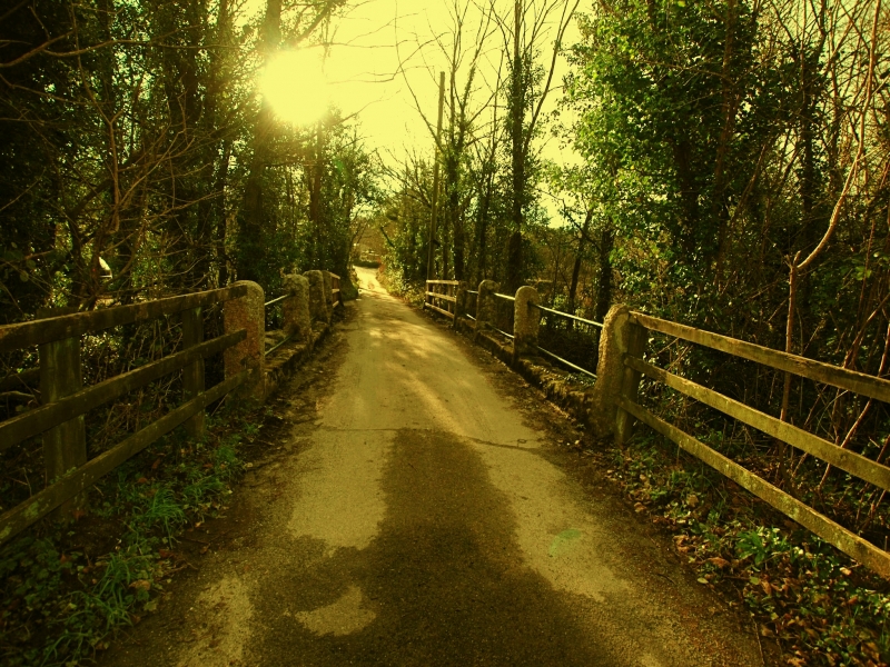
CAMBORNE MENADARVA
SW 64 SW
4/62 Menadarva Bridge
II
Public road bridge over Red River. Probably C18. Killas rubble with granite
dressings. Small 2-span structure with semicircular arches which have
granite voussoirs, triangular cutwater with granite quoins; plain coping of
roughly dressed granite, flat deck protected by modern cylindrical rails set
in roughly-hewn granite posts mounted in the coping.
Listing NGR: SW6141541587
External links are from the relevant listing authority and, where applicable, Wikidata. Wikidata IDs may be related buildings as well as this specific building. If you want to add or update a link, you will need to do so by editing the Wikidata entry.


Other nearby listed buildings
