Latitude: 54.5113 / 54°30'40"N
Longitude: -1.1218 / 1°7'18"W
OS Eastings: 456954
OS Northings: 513244
OS Grid: NZ569132
Mapcode National: GBR NJL8.XL
Mapcode Global: WHD77.QVZX
Plus Code: 9C6WGV6H+G7
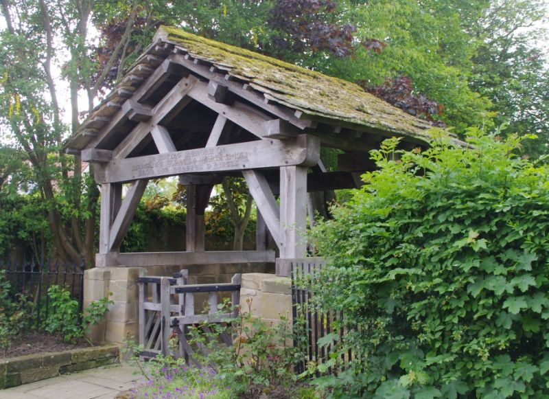
Entry Name: Lychgate, 30 metres to southeast of Church of St. Oswald.
Listing Date: 25 April 1984
Grade: II
Source: Historic England
Source ID: 1311031
English Heritage Legacy ID: 59923
ID on this website: 101311031
Location: St Oswald's Church, Newton under Roseberry, Redcar and Cleveland, North Yorkshire, TS9
County: Redcar and Cleveland
Civil Parish: Guisborough
Traditional County: Yorkshire
Lieutenancy Area (Ceremonial County): North Yorkshire
Church of England Parish: Newton under Roseberry
Church of England Diocese: York
Tagged with: Architectural structure
This list entry was subject to a Minor Amendment on 3 September 2024 to reformat the text to current standards.
NZ51SE
4/55
GUISBOROUGH
NEWTON-UNDER-ROSEBERRY
CHURCH LANE (west side)
Lychgate, 30 metres to southeast of Church of St. Oswald.
GV
II
Lychgate. 1929. Ashlar. half walls with timber superstructure; gabled with stone slab roof. Included for group considerations.
Listing NGR: NZ5695413244
External links are from the relevant listing authority and, where applicable, Wikidata. Wikidata IDs may be related buildings as well as this specific building. If you want to add or update a link, you will need to do so by editing the Wikidata entry.


Other nearby listed buildings