Latitude: 51.7899 / 51°47'23"N
Longitude: -0.8944 / 0°53'39"W
OS Eastings: 476354
OS Northings: 210714
OS Grid: SP763107
Mapcode National: GBR C1P.NPQ
Mapcode Global: VHDV9.G81Q
Plus Code: 9C3XQ4Q4+X7
Entry Name: Westlington Farmhouse and Pump in Yard
Listing Date: 20 March 1979
Last Amended: 11 October 1985
Grade: II
Source: Historic England
Source ID: 1311252
English Heritage Legacy ID: 43087
ID on this website: 101311252
Location: Dinton, Buckinghamshire, HP17
County: Buckinghamshire
Civil Parish: Dinton-with-Ford and Upton
Built-Up Area: Dinton
Traditional County: Buckinghamshire
Lieutenancy Area (Ceremonial County): Buckinghamshire
Church of England Parish: Stone with Dinton and Hartwell
Church of England Diocese: Oxford
Tagged with: Farmhouse Thatched farmhouse
SP 71 SE DINTON-WITH-FORD AND STARS LANE, Westlington UPTON (north side)
3/150 Westlington Farmhouse (formerly listed under Biggs Lane) and pump in Yard 20.3.79
- II
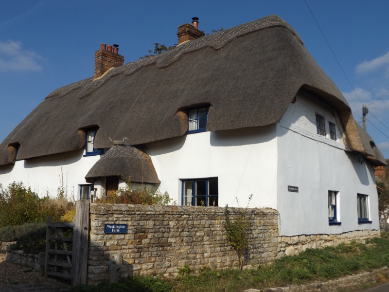
Farmhouse. C17 and C18. Witchert rendered, on a rubblestone plinth, all colourwashed. Thatched half-hipped roofs. One and a half storeys and 3 bays, gable end to the road. One bay rear wing fronts road. In angle a rubblestone C18 block with old tiled roof. West or front elevation has door in shallow porch with thatch roof between right hand bays. 4 pane early C19 sashes. 3 eaves dormers. Stack between right bays forming lobby entry type plan and between left bays. Right hand gable to road has ground floor 4-pane sash, brick gable above band, both colourwashed, and 2- light leaded casement. Rear wing has casements, ground floor one modern. Rubblestone block has single leaded casement window. In the yard a pump with lead spout inscribed 'Castle Plumbery, Thame'. Interior. Inglenook fireplaces and chamfered and stopped spine beams.
Listing NGR: SP7635410714
External links are from the relevant listing authority and, where applicable, Wikidata. Wikidata IDs may be related buildings as well as this specific building. If you want to add or update a link, you will need to do so by editing the Wikidata entry.


Other nearby listed buildings