Latitude: 51.9043 / 51°54'15"N
Longitude: -0.4344 / 0°26'3"W
OS Eastings: 507806
OS Northings: 224022
OS Grid: TL078240
Mapcode National: GBR TPX.RZ
Mapcode Global: VHFRF.FD7H
Plus Code: 9C3XWH38+P7
Entry Name: Moat House
Listing Date: 10 September 1954
Grade: II
Source: Historic England
Source ID: 1311772
English Heritage Legacy ID: 35833
ID on this website: 101311772
Location: Limbury, Luton, Bedfordshire, LU3
County: Luton
Electoral Ward/Division: Saints
Parish: Non Civil Parish
Built-Up Area: Luton
Traditional County: Bedfordshire
Lieutenancy Area (Ceremonial County): Bedfordshire
Church of England Parish: Biscot
Church of England Diocese: St.Albans
Tagged with: House Thatched cottage
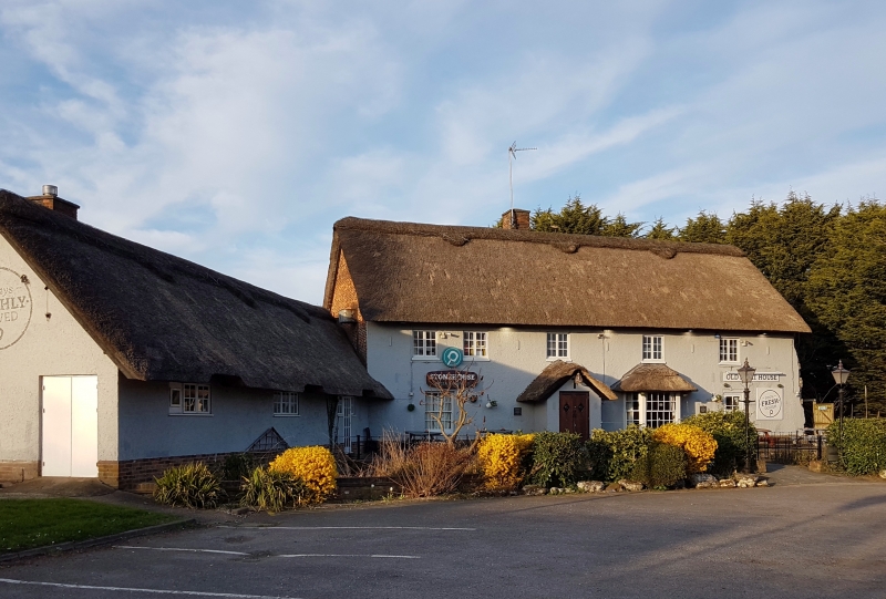
MOAT LANE, BISCOT
1.
5123 Moat House
TL 02 SE 6/1 10.9.54
II
2.
Origins as late C14 manor house within moat; reroofed and altered c 1500 and
subsequently, extensively modernised 1968-69. Stone, rendered apart from
east gable end which is a mixture of clunch, brick and flint; thatched roof,
though tiled before modernisation. Surviving building of rectangular plan,
modern outbuilding to rear. Front elevation (south) has 5 first floor casements;
ground floor left to right, sash, modern gabled porch with front door, C19
thatched bay window with sashes, modern door. Side elevation (east) has brick
in gable apex; full length single buttress at each corner; one square headed
deeply recessed window at left hand, another originally similar now blocked.
Interior now arranged entirely as two storeys, with substantial floor framing,
and inserted modern chimney placed centrally. Eight bay roof structure divided
by 4 large trusses, c 1500 in date. Small gap between 4 bays to west and
4 to east. All 8 have arches to collars and windbraces, 2 purlins and moulded
wall plate. Western half has moulded purlins and battlemented ties above
arched collars. Eastern half similar structure but undecorated. Extensively
renovated. Ground floor plaque formerly in cellar records size of hailstones
in 1666.
Listing NGR: TL0780624022
External links are from the relevant listing authority and, where applicable, Wikidata. Wikidata IDs may be related buildings as well as this specific building. If you want to add or update a link, you will need to do so by editing the Wikidata entry.


Other nearby listed buildings