Latitude: 54.6878 / 54°41'16"N
Longitude: -3.3006 / 3°18'2"W
OS Eastings: 316254
OS Northings: 533303
OS Grid: NY162333
Mapcode National: GBR 5GD7.7B
Mapcode Global: WH6ZR.8FJM
Plus Code: 9C6RMMQX+4Q
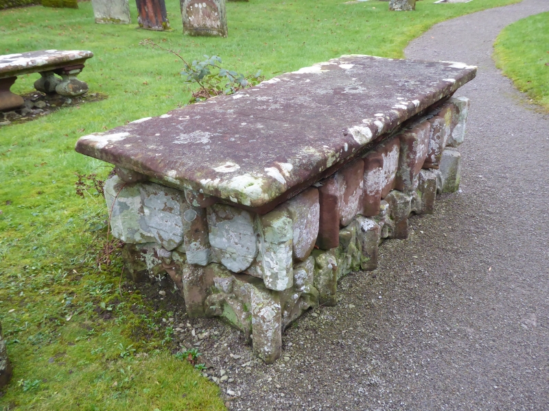
Entry Name: Table Tomb South of Chancel of Church of St Michael
Listing Date: 5 September 1986
Grade: II*
Source: Historic England
Source ID: 1312018
English Heritage Legacy ID: 72553
ID on this website: 101312018
Location: St Michael's Church, Isel, Cumberland, Cumbria, CA13
County: Cumberland
District: Allerdale
Civil Parish: Blindcrake
Traditional County: Cumberland
Lieutenancy Area (Ceremonial County): Cumbria
Church of England Parish: Binsey Team
Church of England Diocese: Carlisle
Tagged with: Tomb
BLINDCRAKE ISEL NY 13 SE 6/28 Table tomb south of chancel of Church of St Michael II*
Table tomb. Late C15 probably for Sir William Leigh of Isel Hall who died in 1484. Red sandstone. Sides have carved trefoils and shields of the Leigh family. Originally inside the church.
Listing NGR: NY1625433303
External links are from the relevant listing authority and, where applicable, Wikidata. Wikidata IDs may be related buildings as well as this specific building. If you want to add or update a link, you will need to do so by editing the Wikidata entry.


Other nearby listed buildings