Latitude: 50.1791 / 50°10'44"N
Longitude: -5.5978 / 5°35'52"W
OS Eastings: 143230
OS Northings: 37204
OS Grid: SW432372
Mapcode National: GBR DXK6.NNZ
Mapcode Global: VH052.XRHK
Plus Code: 9C2P5CH2+JV
Entry Name: Stable and Adjoining Stile at Approximately 45 Metres West South West of Higher Porthmeor Farmhouse
Listing Date: 7 September 1988
Grade: II
Source: Historic England
Source ID: 1312256
English Heritage Legacy ID: 70575
ID on this website: 101312256
Location: Higher Porthmeor, Cornwall, TR20
County: Cornwall
Civil Parish: Zennor
Traditional County: Cornwall
Lieutenancy Area (Ceremonial County): Cornwall
Church of England Parish: Zennor
Church of England Diocese: Truro
Tagged with: Stable
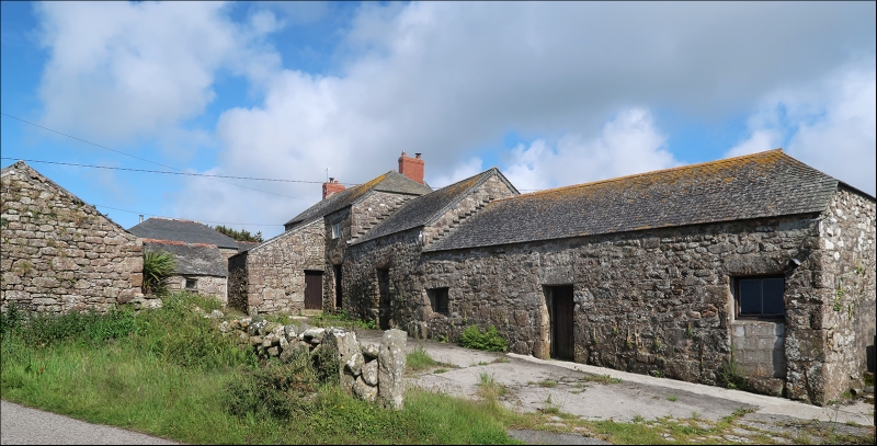
ZENNOR SW 43 NW 3/238 Stable and adjoining stile at - approximately 45 metres west south west of Higher Porthmeor Farmhouse GV II Stable and adjoining stile. Circa mid C19. Granite rubble walls with granite dressings. Asbestos slate roof with gable ends (formerly scantle slate). Plan: rectangular plan with entrance to middle of north-west front probably with stall at either end inside. Exterior: single storey. Symmetrical front with central ledged door and small square window at either side under the eaves, each with original shuttered window with 3- pane overlight. Interior: not inspected. Grid stile adjoins at left. Part of an unspoiled coastal hamlet set in the ancient field system of this part of Cornwall.
Listing NGR: SW4323037204
External links are from the relevant listing authority and, where applicable, Wikidata. Wikidata IDs may be related buildings as well as this specific building. If you want to add or update a link, you will need to do so by editing the Wikidata entry.


Other nearby listed buildings